Showing posts with label Vero area. Show all posts

Sunday, February 10, 2019

2/1019 Report - Some Beaches in the Vero Area Showing Erosion Prior to the Peak Surf.


Written by the TreasureGuide for the exclusive use of treasurebeachesreport.blogspot.com.

Turtle Trail Sunday After High Tide.

You can see the erosion, which was about three feet down by the second flag pole.  You can also see a detectorist to the south in this photo.

On the basis of the beaches around Vero I'd give it a 2 rating on my beach conditions rating scale, which is what I call transitional.

Another View of Turtle Trail South Of The Beach Access Around the Same Time.
None of the erosion control bags were showing, however there was erosion from the access, both north and south.

Turtle Trail Looking North From The Access
The cuts up around the access were not as high as farther south.  There is one detectorist in the distance.

Seagrape Trail Just North of the Access.
The cut by the access was about three feet, but not so big farther away from the access.

Seagrape Trail Just South of the Access.
As you can see this is mostly renourishment sand.

To The North of the Rio Mar Access.

Rio Mar Looking South From the Access.

Conditions aren't great around Vero, but there is some erosion.  I'd give it nothing more than a transitional rating at this point, but I'm not expecting a much more development.  We'll see.

The surf will peak tonight.

Source: MagicSeaWeed.com
The beach fronts were pretty mushy, Maybe the next tide will help out.

Happy hunting,
Treasureguide@comcast.net

Wednesday, May 24, 2017

5/24/17 Report - Vero Area and South Hutchinson Island Beaches. Capitana Crew At Work.


Written by the TreasureGuide for the exclusive use of treasurebeachesreport.blogspot.com.

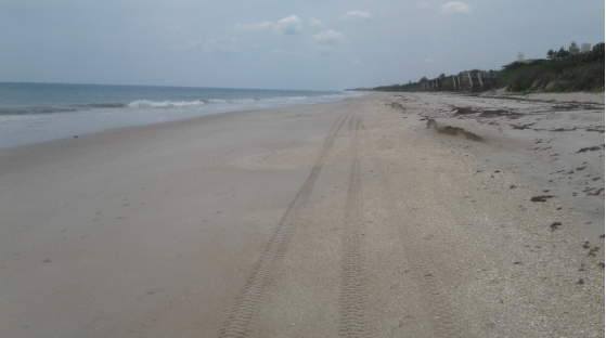
Turtle Trail South Tuesday.
Photo by Darrel S.

Darrel S. sent in some recent views of Turtle Trail yesterday (Tuesday)  In the one above you can see the shell piles that will be of interest to some of you.

Besides shells, you might want to check the shell piles for things such as small fossils, sea glass or pot shards.

Darrel sent in another excellent report today.  Here it is.

Not much change in beach past few days. Low was around 12:30pm.
Deep trench between shells and sand bar. Too mushy to work water edge.

Capitana was out.

My new 12x13 NEL Tornado worked as expected. At first, worked better in the drier sand. Amazed that it found small objects close to surface. Most larger coils lose the top few inches to sacrifice for going deeper, and require lowering sensitivity to work properly. I was able to work wet sand after pumping coil, readjusting threshold, and lowering sensitivity.  I will stick to the 12x8 coil rest time down here. Always have the CZ21!

Turtle Trail South Tuesday
Photo by Darrel S.
A lot of sand below the high tide line here.

Capitana At Work Tuesday
Photo by Darrel S. 
Thanks much for the photos and report Darrel.

---

Things looked similar down on South Hutchinson Island Tuesday.


Walton Rocks Yesterday Near Low Tide.

Shells at Walton Rocks Yesterday.
Looked like the shell piles might have been heavier at Turtle Trail.  I would suspect similar shell piles at places like Ambersands, but didn't see it so don't know for sure.

---

In South Florida one diver died and two more died in a separate boating incident this week.

Take shelter from lightning too.

Here is a link to a story about what it is like to be struck by lightning - if you live.

http://www.bbc.com/future/story/20170523-what-its-like-to-be-struck-by-lightning

---

A one foot surf is predicted for the next week or more on the Treasure Coast.  That means nice calm water.

We are also having some nice negative tides too.

I have some nice find pictures that I'll probably be able to post tomorrow.  A very nice diamond ring, a meteorite and some fossils.

Happy hunting,
TreasureGuide@comcast.net