Showing posts with label Vero. Show all posts

Tuesday, June 23, 2020

6/23/20 Report - Historical Treasure Coast Images From Wabasso, Vero and St. Lucie. A Few Finds.


Written by the TreasureGuide for the exclusive use of treasurebeachesreport.blogspot.com.


Very Round Ball-Shape Object Found Yesterday.

Here are some finds I picked up yesterday.  I don't know what the ball-shaped object might be.  It looks a lot like a cannon ball, but I'll have to do some cleaning and investigate that.

The bottles below are embossed Coca Cola and Stuart Bottling Works bottles.  Both had a lot of shells on them.  The Coke is from Washington, DC.  I think that is the first I got from there.


Embossed Coca Cola and Stuart Bottling Works Bottles.

I've been able to find some information on the Stuart Bottling Works, but don't think I ever found out what they were putting in those bottles.  I'd guess soda or mineral water.

---


The Sea Mist, Wabasso Beach.
Postcard Image Submitted by JamminJack

Yesterday I mentioned using old postcards for research. JamminJack said, I used post cards for research for a long time. Years ago, I donated my collection to Historical Society. It made me feel rewarded knowing future researchers will have access to them.


Below were several used for my research for 1715 Fleet and Treasure Coast. They are accessible online through MyFlorida site. 

This photo was taken before development of Wabasso beach. Check the cars and see if you can figure out the time frame.  


The title reads...

The Sea Mist, Wabasso Beach.

Back then Vero and Wabasdo were one beach. Confuses researchers when reading older articles on wrecks found, etc. 

Do you know exactly where it was?


Penn Wood Court
Postcard Image Submitted by JamminJack


About this one, Jack said, ... Pennwood Court, now Pennwood Motel. Kip Wagner helped with the construction of the motel.


Sexton's Motel Resort.
Postcard Image Submitted by JamminJack.


...Sexton's motel/resort. He was known for taking his guests across the Indian Lagoon to areas where treasure was being found.


St. Lucie State Museum.


3rd image is the building that later became Seal Museum at Pepper Park. This was built after treasure was being found in the Ft. Pierce area. I remember going in this museum.

Thanks to Jack for those images and descriptions. 

---

From DJ...


Your June 22 blog reminded my of a search I could not complete. I found this reference to a casino (highlighted for you) and have been unable to locate the site of the old Casino. The only other reference was an advertisement I found once. I would imagine it would be directly across the Indian River as the barrier island was was only accessible by boat at that time. But thats a large area and many uncertain facts remain. Lots of development since them and most artifacts would likely be covered up by now or in the Indian River under sand and silt, anyway good to think about.

DJ also sent the following image of a great research tool.


Thanks DJ.


Can anyone tell us where the Fort Pierce casino was? I only have a vague recollection that I once knew about it.

---

The low tide was nice and low yesterday.  The surf is still small.

Tropical depress Four is off the New England coast.

Happy hunting,
TreasureGuide@comcast.net

Thursday, September 19, 2019

9/19/19 Report - Beach Conditions Along The Treasure Coast. Ten Centavo Coin.


Written by the TreasureGuide for the exclusive use of treasurebeachesreport.blogspot.com.

John Brooks Early Thursday

I took a look at John Brooks and Frederick Douglass beaches this morning just before 9 AM and found the water coming up fairly high.  It was hours before high tide, and it looked like the water would get as high as after Dorian.  The next two days the water is expected to be even higher than today.

John Brooks Before 9 AM Thursday.


Frederick Douglass Beach Just Before 9 AM Thursday.

Notice the shell line.  There haven't been many shells lately.

Frederick Douglass Beach Just Before 9 AM Thursday.


Yesterday Joe D. visited a lot of the Treasure Coast beaches and sent me photos.  Thanks much Joe.  That should be a lot of help to people wondering what beach conditions are like, whether to make the trip or where to go.

The following series of pictures was taken yesterday by Joe.

Rio Mar.

Vero
Vero Boardwalk

Turtle Trail.
Turtle Trail

Seagrape Trail.

Seagrape Trail.

Wabasso
Wabasso

Golden Sands.


Treasure Shores

Treasure Shores.

Ambersands.


Thanks again Joe.

I looked north of McLarty yesterday and it was about the same.  There were no real cuts anywhere.  The water had been to the foot of the dunes, but where there was a cliff, it was renourishment sand.

I know a lot of people were disappointed so far with all of the high surf we have been having but almost no erosion or cuts.  As I said above, we are supposed to have even higher water the next two days.

I think the big problem is all of the renouishment sand.  It is still protecting the dunes, and there is a lot of it out in front of the beaches too.  Also, the water has been hitting the beaches directly from the east instead of at a an angle.

At this point I can't rate beach conditions as any higher than a 1 (poor).  Maybe that will change soon.  We can hope.

---

Here is a coin that John E. says matches his find that I posted yesterday except he isn't able to make out the date.

Cuba 10 Centavo.

Alberto S. commented on that coin.

Very interesting find of a Cuban coin in Vero, makes you wonder how it ended up on a beach there, maybe an American tourist visiting Cuba and returning with some pocket change? As to the words on top of the star; Patria y Libertad translated to English; Country and Liberty. You would find those words on coins of the time which were minted in Philadelphia for the government of Cuba, actually there were several coins minted in Philadelphia see the attached list published by the NGC Collectors Society. The coin found by John E. is probably a Cuban 10 cent coin and not a 1 cent, there are some differences and in the attached image I tried to show some features that distinguish the 1 cent from the 10 cent coins, similar markings are on the 20 cent and the Cuban peso but since he said it was the size of a dime then it probably is the Cuban 10 cent coin, one additional detail is that the C which is visible in the coin that he found is slightly off center which is not something you see in the 20 cent or peso where the first letter of centavo or peso seems to start at the center also, but not sure, I think there is an E following the C.  Personally, I would have been thrilled to make such a find as it is from my country of birth.


Thanks Alberto.

If I correctly recall, Sebastian Steve found a similar coin on a Treasure Coast beach.  It does make you wonder how it got there.

There is plenty of weather to watch.  I'll stay on that.

Happy hunting,
Treasureguide@comcast.net

Wednesday, September 18, 2019

9/18/19 Report - Hurricanes Humberto and Jerry. Erosion in Jupiter Area. Silver Find From Vero Area. And More.


Written by the TreasureGuide for the exclusive use of treasurebeachesreport.blogspot.com.

Source: nhc.noaa.gov
Look at that!  Humberto hasn't completely left yet, and it looks like there will be a Hurricane Jerry headed in this general direction.


Source: nhc.noaa.gov

That could send us even more surf.

I haven't been out and around much yet, but hope to get out this afternoon and should be able to give you a beach conditions rating later today.


With Jerry following Humberto, we might get continued higher surf.


Eroded Beach in Jupiter Area
Photo by Jerry P.
Jerry said he used Ventusky.com, which you'll find on my first blog page, to find an area where conditions might be good, and he found this nicely eroded area.\

Thanks for sharing Jerry.  Very good use of Ventusky to find a good detecting site!

---

Here is one nice find from the Vero area.

John E. said, I’m stumped on this one.... exact size of a dime , registers a 21 on equinox 800..... found in about 14 in deep wet sand on treasure beach in vero, can anyone identify?

John E


Find and photo by John E.
He said the words above the star are FRIAY LIBER.

Other Side of Same Coin
Photo by John E.
I'm pretty sure it is a centavo from Cuba and can almost make out a date below the star.  I'd also guess it is silver.  Looks like it to me.   A little research should provide the denomination.

Thanks John.  Nice find!

---

Here is an interesting email message I received from Southern Digger concerning a link I posted yesterday.


Hello TG 

Been awhile corresponding but still following up. Archeological site locations on Hutchinson Island and elsewhere along the beaches is no big secret. I recall an old beach mound near the now closed Indian River inlet. I believe some of it has since been washed away. Years ago, a friend and I hiked to a hammock Island near Round Island Park, long before this hammock was developed. We used machetes to cut in to the center, finding old metal rods with eyelet ends which appeared to be from old sailing ship mast supports. Why they ended up way back of the beach we never could determine, unless a camp was made thereon by some 1800's shipwreck survivors.  Also, prehistoric evidence was everywhere. Thought it was interesting and a possible site to return to, we never did, that is until major changes took place thereon. Since then, the under-story was cleared and Univ. of Maryland (I believe) did an archeo survey on the hammock. I was invited to return after that, and did so--still seeing prehistoric evidence in abundance scattered everywhere. This was my last visit when construction began thereon for some type of structure. Another archeo site way to the south exists behind the beach at the water plant. I was asked to direct the Archeo. survey via an Env. firm I worked for at the time--but turned it down and recommend someone else because the end of the survey results and how the report should read were told to me before the project even started. In effect, regardless or not if there are burials. the site would be dozed and built upon. I turned it down even though I would be hired to direct the project because, at the time, I was being trusted on several other volunteer archeo. projects to the south which did not involve the Env. firm; and, I did not want a reputation of being a sellout for the $$$$ and destroy possible burials. That is a strict policy I adhere to to this day because I have seen way to much archaeological and historical sites destroyed and developed in which I had no control over or the power to prevent it from occurring. That is the nature of land development and the destruction of Old Florida. 

Thanks Ken.

--

I hope to get out this afternoon. I expect to be able to post a beach conditions rating after that - maybe later today.

At this point I am expecting a few reales to be found this week.

---

PM Update.

I looked at a few beaches in the Vero/Sebastian area and saw nothing encouraging at all.   I'm expecting fewer finds now than what I just said above.

Happy hunting,
TreasureGuide@comcast.net

Sunday, September 15, 2019

9/15 Report - Photos From Around the Treasure Coast and More High Surf Predicted.


Written by the TreasureGuide for the exclusive use of treasurebeachesreport.blogspot.com.

John Brooks Saturday Evening
I got out last evening just before dark to look at a few beaches.  Here is John Brooks.  There was no new erosion there.  There was none at Frederick Douglass either.


John Brooks Beach Saturday Evening.


Turtle Trail Saturday Morning.
Photo by DJ
DJ took these photos of Turtle Trail on Saturday.  It looked better than what I saw on South Hutchinson Island.  Note the increased slope on the front beach.

Turtle Trail Saturday Morning.
Photo by DJ
DJ also sent the following photo from Rio Mar.  It also has a slope on the front and some black sand.

There is still a lot of sand there.  I can remember when there were a bunch of huge concrete blocks showing there and the beach was cut back into the dunes.


Rio Mar Saturday.
Photo by DJ


Vero Near Mulligan's 
Photo by Gaylen C.
Galen C. sent these photos of the Vero area.  People sometimes forget that silver reales have been found in that area.  I remember one found right in front of the Holiday Inn.


Vero Boardwalk
Photo by Gaylen C.
There has been a lot of talk about the Vero Boardwalk.  There has been erosion there for quite a while.


Source: nhc.noaa.gov
Humberto is moving away from us, and the other system in the Atlantic is still far away.


Source: MagicSeaWeed.com

The surf predictions don't look bad.  If they are correct, we will be getting some higher surf for an extended period.  Tuesday or thereabouts, we'll be getting some north winds.  All of that surf should help some.

Beach conditions have been generally poor for a few years now.  All of the sand from the beach renourishment projects has not helped.  Most beaches still have a lot of sand.

The Vero area looks a touch better than the South Hutchinson Island beaches.

There are still places out there where there has been enough sand moved to uncover modern items.  Last night after checking out John Brooks I stopped a little to the north on the way back and quickly picked up 19 modern coins in a short amount of time.  That was my third test of the Equinox in the field.  I only dug coins.  I didn't dig one piece of junk, and I didn't dig anything better.  I was moving ridiculously fast.  It wasn't a fair test.  My wife was with me and it was getting dark and we got hit by a passing rain shower.  I could have easily missed a piece of gold or something.  It has been surprising me how many modern easy modern coins are out there to be found.  I guess folks are focusing on shipwreck stuff even though they have been difficult to find.

Thanks to all those who sent photos.  You make this possible and help everybody.


Happy hunting,
TreasureGuide@comcast.net


Friday, September 6, 2019

9/6/19 Report - Indian River County Says No To Tourism and Keeps Beaches Closed. Bad Hurricanes Not New. A Few Finds.


Written by the TreasureGuide for the exclusive use of treasurebeachesreport.blogspot.com.

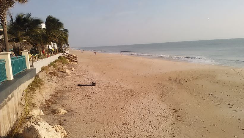
Vero Beach This Morning.


Indian River County Turns Away Tourists and Beach-Goers.  

If you came to Florida to visit the beaches, stay away from Indian River County.  The county beaches were closed.

Two were being guarded by the Sheriff's Office.  Marked cars were parked in front of the closed gates at both Turtle and Seagrape Trails the past few days.  I don't know why the extra expense to guard those two particular beaches was necessary.

The gates were closed this morning at Turtle Trail, Seagrape Trail, Wabasso, Treasure Shores, Golden Sands, Amber Sands, and probably others that I did not see.

At least a dozen cars were parked along the road by Treasure Shores this morning.  I noticed one older couple walking into the park.

Several detectorists were also parked along the road about half way between Wabasso and Seagrape Trail.  There is a path there that has been used by detectorists for decades.

You can get onto the beach at Vero (See photo above.).  One detectorist was busy there this morning. There was apparently no danger there.

The gates at Rio Mar were also open, but there were no parking spots open. 

Round Island park was also closed.

---

Pablo M. Sent This Photo of a 9/4 Find From Turtle Trail.
Pablo M. sent this photo of a find from Turtle Trail.  I can't quite make it out.

---

Dave sent this message and a photo of his recent finds from Walton Rocks.

Hello. Yesterday I started at south end Walton Rocks, up high in front of condos and found some hard pack cutting into dunes. Tide hitting as I left.  A lot of clad, lures,sinkers,1 piece silver ,old wood iron banding still attached. As always you are spot on when it comes to your posts., I appreciate all the hard work it takes. Look fwd to your blogs end of every day.   Dave.

Walton Rocks Finds.
Finds and photo by Dave.
---

Dorian may not be as unique as some suggest.

One of the most fatal hurricanes in history hit West Palm Beach in 1928 as a category four, killing at least 3500 people when Lake Okeechobee overflowed.

While the 1928 storm was the most deadly, the most powerful storm hit on Labor Day of 1935

The other irony: while the Okeechobee storm was one of if not the deadliest in state history, the most powerful meteorologically was a storm that came as the strongest one in recorded U.S.  history on September 2, 1935 — Labor Day. Originally, it was projected to hit on the same date (until it slowed, coming in now, they say, early Wednesday, if at all; we’ll see soon…). No other storm had lower barometric pressure (892) nor greater wind speed (at one point sustained winds of 185, at least for a full minute). But now Doria is about that same strength. The Labor Day Hurricane’s storm surge was eighteen to twenty feet, badly damaging the Florida Keys and actually obliterating one of them, Islamorada. We once interviewed a survivor who lost virtually everyone in his large family and had to swim all night in the dark as a child.

“It’s devastating,” said Joy Jibrilu, director general of the Bahamas’ Ministry of Tourism and Aviation. “There has been huge damage to property and infrastructure. Luckily, no loss of life reported.”

With its maximum sustained winds of 185 mph (295 kph) and gusts up to 220 mph, Dorian tied the record for the most powerful Atlantic hurricane ever to come ashore, equaling the Labor Day hurricane of 1935, before the storms were named.
Source of quote: https://spiritdailyblog.com/commentary/remembering-two-storms

---

Three deaths in Florida were attributed to injuries sustained during hurricane preparation.  I can only imagine how many other injuries there were.

I have some good emails on that subject that I'll probably post in the future.

I expect to have some more find photos to share before long.

That is all for now.

Happy hunting,
TreasureGuide@comcast.net

Saturday, August 31, 2019

9/1/19 Report - Beach Closings and Beach Conditions, Including Some Early Erosion.


Written by the TreasureGuide for the exclusive use of treasurebeachesreport.blogspot.com.

Fort Pierce South Inlet Park Afternoon 8/31.
I took a look at some of the South Hutchinson Island beaches Saturday afternoon.

The gates at John Brooks and Frederick Douglass beaches were closed when I was there, which was around 3 or 4 PM.  I could not see any reason why they were closed, especially considering that you could visit the other neighboring beaches.

I also saw barricades on the west side of the causeway, but they were on the side of the road instead of blocking the causeway.  It seemed they either planned to block the causeway and decided not to, or were getting ready to.

Fort Pierce South Inlet Beach 8/31 Around 3 or 4 PM.
There was already some erosion at some locations, as you can see from the following photos.

South Hutchinson Island 8/31 Afternoon.

South Hutchinson Island Erosion 8/31 Afternoon.

North of John Brooks 8/31 Afternoon.

---

DJ drove from Sebastian to Vero on a little earlier in the day and found all of the Indian River County beach accesses closed, including Wabasso.  He did walk over the dunes north of McClarty and took the photos below.  He said he saw two other detectorists.

North of McLarty Afternoon 8/31
Photo by DJ

Beach North of McLarty on 8/31
Photo by DJ

North of McLarty on 8/31.
Photo by DJ.
---

The surf is supposed to begin building on Sunday.

It seems that all of the Vero and Indian River County beaches were closed except for the beaches between McLarty and the Sebastian Inlet.

On South Hutchinson Island the gates were closed at John Brooks and Frederick Douglass beaches, and possibly other beaches. You could however visit some of the other beaches.

There was some erosion at a few spots. I could see that the high tide had been high on the beach.

I'm posting this early, but I had a lot of material ready.Please let me know of any other beach closings or openings.  Thanks in advance.

Source: MagicSeaWeed.com.


Happy hunting,
TreasureGuide@comcast.net