Written by the TreasureGuide for the exclusive use of treasurebeachesreport.blogspot.com.
 |
| Locked Gate. |
I received this email from a veteran and regular reader of this blog.
I have really been troubled with the beach access situation in Indian River County. I am tired of walking around in the evening like I am some kind of criminal. As a war vet I love being back in America and love going to the beach. Especially at night. My family, friends and I love to fish at night, walk the sunsets or clear star nights and turtle walk. Why then are we denied access to our beaches for over 20 miles in IR County.
I found the DEP site I linked below and reported every access point as an issue due to gates being closed. They should only be closed in a dire emergency. The beach is not the county's, it belongs to the State.
As such, it is held in the public trust under the Public Trust Doctrine. I believe you will find that IR County is in violation of State law and the trust, and I urge all your readers to mark every spot (ambersands, turtle etc.) and report it.
Sometimes the government does things because they can and no one objects. This does not mean it's right. It's time to tell our public servants this is our land and we demand the gates be left open.
I am pro law enforcement and welcome their patrols but they should not be used to guard locked gates to keep law abiding citizens away.
Thanks for your daily work
DZ
Thanks DZ. I've received emails from others that are upset about the beach closures as well.
I find it very curious that our beach accesses are more heavily guarded than our national border. Why should it be easier for a terrorist to walk across the US/Mexico border than for a US veteran to walk onto an Indian River County beach?
GB had something to say about that yesterday. See that post.
If danger is the issue, they'll have to construct safety fences around the ocean like those used for home swimming pools. Lets face it. Life involves risk and danger.
Get ready for beach closures this summer too. Just the mention of a storm will open up federal dollars for beach renourishment.
---
From Russ P.
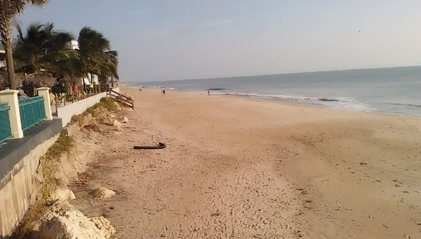
I made my way to the Treasure Coast early Wednesday morning. As has been well reported, there were unmanned patrol cars in front of the closed Turtle Trail and Seagrape accesses.
I arrived to TT at 7am. There were no cars parked outside the access. I moved on to Seagrape and there was a single private car parked outside the access, so I decided to quickly check it out. As I was walking to the access, I met the sole detectorist walking back to his car, reporting "no luck". I took a quick look and although the water had hit the dune wall, there was a fairly steep slope with some mushy sand, so overall not much improvement. There was not a single person on the beach at that time. I did not detect.
Later, I met a detectorist who told me that, the day before, he had been escorted from Turtle Trail by police until they saw him cross the bridge in his car. He repeated the story that the officers' approach is to keep other detectorists off the beach so they have no competition while they detect.
I wonder if there is any truth to that rumor. On one hand, I find it unlikely. However, judging from what I saw at Seagrape that morning, there was absolutely no reason for the access to be closed. It was in good condition with a safe beach and beautiful surf. Frustrating.
Thanks Russ. All reports that I received so far indicate beach conditions at the closed beaches were not much improved by Dorian.
---
From Jeff C.
I detected the beach just south of the Vero Disney resort on Thursday. Like most of your other readers, not much found except for lots of can slaw! Conditions were not very good. A flat beach and lots of mushy sand. But the reason I’m writing you is as I was searching a nice shell line , I remembered your posts about looking for fossils amongst the shells . Within 2 minutes of that thought a sharks tooth was right in front of my coil.. a few minutes later what looks like possibility a horse tooth.. thanks for broadening my searching mentality.. I was genuinely excited to find something that old.
---
From Jeff C.
I detected the beach just south of the Vero Disney resort on Thursday. Like most of your other readers, not much found except for lots of can slaw! Conditions were not very good. A flat beach and lots of mushy sand. But the reason I’m writing you is as I was searching a nice shell line , I remembered your posts about looking for fossils amongst the shells . Within 2 minutes of that thought a sharks tooth was right in front of my coil.. a few minutes later what looks like possibility a horse tooth.. thanks for broadening my searching mentality.. I was genuinely excited to find something that old.
 |
Shark Tooth and Barnacle(?)
Finds and photo by Jeff C.
|
I forget if I mentioned seeing a fossil in the shell line after Dorian.
By all accounts it seems like the closed beaches were no better than the other easily accessible. beaches.
---
From Curt B.
In your 11/7/2010 blog you posted pics of a small silver object. I used to do a lot of E-waste scrapping and that little object looks a lot like a contact from an industrial breaker. The contacts are soldered on to a copper arm. The contacts are 40% silver. In the industrial breakers they vary in size but that looks like a lot of ones I have scrapped out over the years. Hope that helps in identifying it.
Thanks Curt. I would never come up with that.
---
One of the interesting things about Dorian and how the surf quickly dropped off, is that the low surf after the storm would not fill the beaches in again right away - that is if there was much erosion to be filled in.
I wasn't worried about getting out quick. If there were any good spots, especially those that aren't detected as much, you could get out and detect those beaches days later.
---
I should point out that John Brooks and Frederick Douglass beaches were closed slso while other nearby beaches were open. John Brooks and Frederick Douglass weren't closed as long as Seagrape and Turtle Trail though.
Very few finds have been reported so far.
There are still some things in the Atlantic to watch.
 |
| Source: nhc.noaa.gov |
Happy hunting,
TreasureGuide@comcast.net