Written by the TreasureGuide for the exclusive use of treasurebeachesreport.blogspot.com.
 |
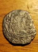
Find Posted on Facebook.
Photo Forwarded by Kenneth T.
|
 |
Other Side of Same Coin
Forwarded by Kenneth T.
|
Thanks much Kenneth!
---
I was going to do a detailed look at sweep patterns today, but I didn't get it ready yet. It will take some time for me to make the illustrations.
I've talked before about the importance of knowing the area of sensitivity for your coil. The area can vary for different areas of your coil. Here is a simple illustration.
A concentric coil will typically have a more cone shaped area of sensitivity. It will be most sensitive near the center of your coil.
A Double D coil will have an area of sensitivity that is consistent from the front to back of your coil. A target under the front or back of the coil will be detected about as deeply as a target that is under the center of the coil.
I haven't always found that to be true when I personally tested coils, but that is what you'll see in the literature. I believe in mapping the area of sensitivity for a coil by using an air test. Move objects under different areas of the coil and see what kind of depth you get under different areas.
I've had some coils that for which the area of sensitivity was very wide. I could detect targets to the edge and beyond. Other coils on the same detector wouldn't do that. In any case, it is good to know what the area of sensitivity is for the coil you are using.
If you have a concentric coil with a cone shaped area of sensitivity and make three sweeps without overlapping your sweeps, you'll be missing half of the area you thought you covered.
Lets say you have a coil that has a cone shaped area of sensitivity and you make three sweeps but are not careful to overlap each sweep.
You can see from the above illustration that you would be missing about half the ground that you thought you had covered. A lot of overlapping would be required to get maximum depth over the area you are covering.
No matter what type of coil you have and no matter what the literature says about it, I recommend personally mapping out the area of sensitivity for you coil. You will then know for sure what you are working with and what you need to do.
---
 |
| Three Systems Shown on the National Hurricane Center Map. |
1. A weak area of low pressure, associated with a tropical wave located
a little more than 900 miles east of the Lesser Antilles is
producing disorganized showers and thunderstorms. Although some
slight development of this system is possible today or tomorrow, by
Thursday, upper-level winds are forecast to become unfavorable for
tropical cyclone formation. This disturbance is expected to move
slowly westward across the tropical Atlantic Ocean for the next
several days.
* Formation chance through 48 hours...low...20 percent.
* Formation chance through 5 days...low...20 percent.
2. Shower activity associated with a surface trough interacting with
an upper-level low near the north coast of Hispaniola northeastward
over the southwestern Atlantic has increased a little since
yesterday. Little, if any, development of this disturbance is
expected during the next few days while it moves west-northwestward
across the Bahamas and the Florida peninsula. However, environmental
conditions could become a little more conducive for development
when the system moves into the Gulf of Mexico over the weekend.
Regardless of development, this disturbance will produce periods
of locally heavy rainfall across the Bahamas through Thursday, and
across Florida on Friday and continuing into the weekend.
* Formation chance through 48 hours...low...near 0 percent.
* Formation chance through 5 days...low...30 percent.
3. A tropical wave located just off the west coast of Africa is
expected to move quickly westward during the next several days.
Some slow development is possible late this week and over the
weekend when the system is several hundred miles east of the
Lesser Antilles.
* Formation chance through 48 hours...low...near 0 percent.
* Formation chance through 5 days...low...20 percent.
So it looks like Number Two could move across Florida, but probably not as a strong storm.
Keep an eye on these. It won't be long before we get into the Fall season, which is when we got some of our most productive storms in the past, including the famed Thanksgiving Storm of 1984.
---
Happy hunting,
TreasureGuide@comcast.net

