Showing posts with label Frederick Douglas beach. Show all posts

Monday, February 11, 2019

2/11/19 Report - South Hutchinson Island Beach Conditions. A Few Finds.


Written by the TreasureGuide for the exclusive use of treasurebeachesreport.blogspot.com.

A Few Junk Finds From Sunday.
The finds above include two pieces of copper, one completely encrusted on one side, a small lead buck shot, and a small rounded button.  The button needs some cleaning.

John Brooks Beach Monday Around 1 PM.

Since the last time I was there, John Brooks beach filled in more, and there is more seaweed.

Another View of John Brooks Monday Afternoon.
The cliff face is not as high as it was Saturday.

Frederick Douglas Beach Monday.
Frederick Douglas is deteriorating too.  It wasn't as good as John Brooks to begin with.

What I wanted to show with this photo is the buried seaweed on the front beach.  You can just see the top of it sticking out of the sand.

Fort Pierce South Jetty Monday Afternoon.
The cliff was sharp and high, however the sand in front of the cliff was pretty mushy.  A quick check revealed a smattering of modern coins and very little junk.

Overall, the South Hutchinson Island beaches are very impressive right now.

I don't know about Vero today.

---

You might remember the gold Pelican of Piety artifact and the article Laura Strolia wrote about that.

Here is another article about the pelican icon.

http://thecatholicspirit.com/faith/focus-on-faith/faith-fundamentals/why-the-pelican-with-chicks-is-a-symbol-of-the-eucharist/

---

Source: MagicSeaWeed.com


Thursday, November 9, 2017

11/9/17 Report - Griffin Warrior's Carved Agate Seal Stone. Around the Treasure Coast. Bigger Surf Coming This Weekend.


Written by the TreasureGuide for the exclusive use of treasurebeachesreport.blogspot.com.

Griffin Warrior Seal Stone.
Source: See nytimes link below.


This is the kind of thing I'd like to find.  It takes a lot for something to really impress me anymore, but this does it.`It is beautiful.  The workmanship astounds me. And it is a very personal item that could possibly be tracked to a specific individual.  I don't know what the value would be; that isn't what impresses me.

Here is how the article begins.

Two years ago, archaeologists excavating an ancient grave at Pylos in southwestern Greece pulled out a grime-encrusted object, less than an inch and half long, that looked like some kind of large bead. They put it aside to focus on more prominent items, like gold rings, that also were packed into the rich grave.

But later, as a conservator removed the lime accretions on the bead’s face, it turned out to be something quite different: a seal stone, a gemstone engraved with a design that can be stamped on clay or wax.

The seal stone’s image, a striking depiction of one warrior i


n battle with two others, is carved in remarkably fine detail, with some features that are barely visible to the naked eye. The image is easier to appreciate in a large-scale drawing of the original...

Here is the link for the rest of the article about the Griffin Warrior seal stone.

https://www.nytimes.com/2017/11/06/science/greece-griffin-warrior-archaeology-homer.html?_r=0

---

Here are some more photos from Darrel.  These were taken yesterday.

Frederick Douglas Beach Yesterday.
Photo by Darrel S.
Wrecked on Frederick Douglas.
Photo by Darrel S.

Rio Mar Yesterday
Photo by Darrel S.
Along the Vero Beach Boardwalk Yesterday.
Photo by Darrel S.
Darrel sent photos of a few other spots too, but the beaches look pretty much the same everywhere.

Thanks for all the photos Darrel.

---

Maybe you noticed that at the site of the church shooting they were using Garrett detectors to find the shell casings.  Not surprising, being that they are in Texas.

---

The remains of Rina are now in the North Atlantic above 45 degrees north.

As I said yesterday, a cold front is supposed to come through Friday and cause a higher surf on the Treasure Coast.

Source: magicseaweed.com.

With the cold front, we'll get a north wind on Friday.  The high tides are still high.

Happy hunting,
TreasureGuide@comcast.net

Sunday, October 9, 2016

10/9/16 Report - Many Detectorists Continue to Scan the Wreck Beaches of the Treasure Coast Sunday. Few Cuts Anywhere On Treasure Coast After Matthew.


Written by the TreasureGuide for the exclusive use of treasurebeachesreport.blogspot.com.


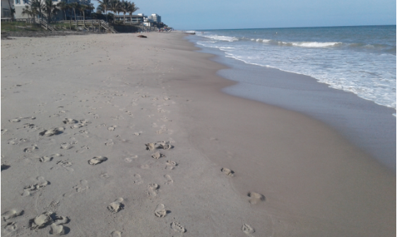
Access South of Frederick Douglas Beach
This is a beach that is south of Frederick Douglas.  It is not a wreck beach and I saw no detectorists there this morning, but the wreck beaches still had a lot of detectorists scanning the beaches.

Notice in the above picture the two different colors of sand.  There is brown sand on the front of the beach (right).

I'll comment on this more later.  The same thing could be seen on other beaches as well.  It tells you a little about what happened during and just after the storm.


Frederick Douglas Beach This Morning Looking South
Above you can see some of the detectorists at Frederick Douglas Beach this morning.  There were a lot more.  Notice the lack of cuts.

There was an interesting dip where high water ran off from the dunes and back to the water.  I tried to take a picture of it, but it didn't show well.

Frederick Douglas Beach Looking North This Evening
Above is a picture of John Brooks Beach looking north.  Again you can see the front beach where the new sand washed up recently.  I'll explain what I think took place later - maybe tomorrow.

Looking South At John Brooks Beach This Morning
You can see some more of the detectorists that were out this morning in the above picture,

Layers Of Sand Washed Up Lat High Tide
Here you can see how the sand washed up onto the beach after any earlier erosion.

---

I received a lot of good emails since the storm, but I had no power until Saturday afternoon and had very limited internet access.  I didn't get to my emails like I usually do.  Sorry if I didn't get back to you.

There were all kinds of great emails.  I'll try to share some in the future.

I appreciate all of the emails sent by my kind readers, and want to say how much I appreciate the kind sentiments.

Here is one such email from Terry T. talking about Friday.

Just a little info - you may already know. We could not drive to the museum along A1A. It was covered in mud, and "stuff". Law enforcement had it shut down. We made the hike from a little south toward the museum and turned back around after seeing no erosion. Stopped at treasure shores, golden sands, wabassso, seagrape, rio mar, turtle trail, FIT, and a few other spots in between. It honestly looked like regular summer conditions with a little mess on the beach from branches and piling's. The first trough had branches - big branches in it rolling along in the smooth surf. The cut at the dune wall was a max of about 8' (turtle trail). Had to duck very low under branches to get their along the trail. I don't think the surge was strong enough to penetrate the renourishment sand in many places, and expose any goodies. All the beaches looked very much just like before the storm in this area.

For a cat 4 passing 30 miles off the beach here - I was in shock when I saw very, very, VERY little erosion. I am sure some goodies will be found, but what ever happened out their overnight was the complete opposite of what I expected.


Thanks much for your report Terry.  Under more normal conditions I would have posted it sooner.

The sidewalk along the river was torn up by the rough water washed against it by the west winds. It seems we sustained more damage from the west wind than anything else. Along much of the Treasure Coast water washed onto A1A from the river.  The beach was also affected more by the west wind than any north/northeast wind.  I'll talk about that more some other day.

I got reports and pictures from Jupiter too.  The report was that they fared about the same as us,only maybe less.  Not much improvement.

I have more to share but that will be all for now.

Happy hunting,
TreasureGuide@comcast.net

Wednesday, April 6, 2016

4/6/16 Report - Beaches Around The Treasure Coast This Afternoon.


Written by the TreasureGuide for the exclusive use of treasurebeachesreport.blogspot.com.

It was windy last night and this morning as the cool front came through.  I wanted to get out to see what the beaches looked like but didn't get to until this afternoon.  Here is what I saw.

Frederick Douglas Beach This Afternoon Near Low Tide.
Frederick Douglas looked interesting - more interesting than shows from the photo.  For one thing, between the peaks you see here, there were cuts in between.  The cuts were unusual.  I don't remember seeing cuts just like that.

The front beach was relatively firm, and the cuts up around the bend were not spaced like the ones shown here.

I'd say beach conditions definitely improved a little here, but maybe not enough to find cobs - at least not in numbers.

Pepper Park This Afternoon Near Low Tide.
No cuts here.  And the beach front was not low.  The only good thing about this beach is the dip in the shallow water.

Two Detectorists At Pepper Park.
 One of these detectorists had a Garrett Ace.  I heard him say he found eleven cents.  I think the other fellow (bending down) had a Bounty Hunter.

Turtle Trail Looking North This Afternoon
The Turtle Trail beach had features that looked very much like those of Frederick Douglas.  It was surprisingly similar.

South of Turtle Trail This Afternoon.
This is the area that was producing back at the end of 2015.  Notice that the blue bags are not showing.

Area North of Seagrape Trail.  
Not much interesting around Seagrape Trail.  However, the front beach was firm.  It was similarly firm around Turtle Trail.

Digger North of Seagrape Trail.
This detectorist was digging one big hole.  I've seen other people trying to remove the same item over the years  So far none were successful.  Maybe this guy will be.  If he does dig it up, can he carry it away.  Maybe.  I once carried a fairly large anchor a long distance.  I wouldn't do it today.

There it is.

Thanks for your responses on the blog poll.

Happy hunting,
TreasureGuide@comcast.net

Wednesday, January 6, 2016

1/6/16 Report - A Quick Survey Of Some Treasure Coast Treasure Beaches This Morning. More To Come.


Written by the TreasureGuide for the exclusive use of treasurebeachesreport.blogspot.com.

Frederick Douglas Beach This Morning Just Before Low Tide.

Yesterday I wasn't able to get out much.  I did get to see one beach but that is all.  Today I took a look at more beaches, but it looks like things have already changed some.

Most of the beaches, like the one above, had seaweed this morning.  That is a sign that sand was
accumulating.

View From The Seagrape Trail Beach Accsss This Morning Before Low Tide.
You can see the seaweed here too.

I also took a picture at Turtle Trail but messed that picture up.  Too bad.  That was the best looking beach that I saw this morning.

From the beach access, it didn't show much other than a small cut running along the high tide mark, however to the south, between the two flag poles, the blue erosion control bags were very visible - more than I've seen for quite a while and most certainly more than I've seen in the past few months. At some spots there was a new three foot cut.  However, in front of the bags it appeared that sand had accumulated again.  I found some things there but they all need cleaned before I know what they are.

I saw seven detectorists there this morning but none at the other beaches that I visited.

Wabasso Beach.
Wabasso didn't look very promising either.  Again, you can see the seaweed.

Rio Mar had about a one foot cut, but again you see the seaweed.


Rio Mar This Morning Before Low Tide.

It appears that the best time was when the front first came through. That is often the case.  It isn't uncommon for the wind to start from the north, shift to the east and then the south.

We've had a lot of those lately where the front moves through and the wind shifts through the cycle fairly quickly.  Windows have been opening and closing in quick succession.

An injury kept me off of the beach when the front first came through and most of yesterday and I kept my hunt short today.  I didn't want to push it, nonetheless I managed to pick up a few things, mostly crusty and unidentified at this point.  I'll do some cleaning and maybe post some photos when I can.

We;re supposed to have three days with a surf in the 4 - 7 foot range.  That is welcome, but only one morning is the wind supposed to be from the north, then it will shift again.

That is all for now.

Happy hunting,
TreasureGuide@comcast.net

Saturday, January 2, 2016

1/2/16 Report - Current Beach Conditions. Beach Zones.


Written by the TreasureGuide for the exclusive use of treasurebeachesreport.blogspot.com.


Frederick Douglas Beach Saturday Evening.
The wind shifted yesterday so I went out to see what was going on.  Above is a picture of Frederick Douglas beach.  You can see that there is a lot of sand on the front of the beach.  Much of it is relatively new.

The sand on the front beach is more coarse and light in color.  So far it hasn't eroded much.

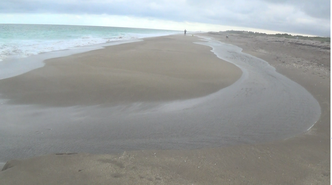
Water Running Back Into The Ocean.
Above is one interesting feature that I saw.  Nothing significant really - just interesting.

I also visited another beach a few miles away.  It showed no sign of significant new erosion yet either.

Fort Pierce South Jetty Park.
Look how much renourishment sand has disappeared here already.  That renourishment sand was disappearing even when there was no erosion any place else.

In front of that twelve foot cliff is some new sand, very much like at Frederick Douglas.

There was a group of students from the University of Pittsburgh there for some reason.  That is one of my alma maters.

We are supposed to have a two or three foot surf for a couple of days and then up to six feet Tuesday and Wednesday.

We should have another day of north winds.

---

I'll be discussing some things from the following illustration.  Today just a little of that.


Detecting Zones.

It can be useful to consider each zone.  It is easy to get stuck in a rut and only detect one zone or another.  As I've said, the new year is a good time to look back and also to think about the future.

I added some arrows to this illustration.  The blue arrow points to the area between the berm and dunes. That is the dry sand area.  Some people hunt that area exclusively.  There are times, such as during periods of especially high surf or tides, when that area does get wet.  In fact there are places where the water can go completely over the dunes and into the lagoon, although that is very rare.

The area indicated by the blue arrow is an area where people who hunt modern coins and jewelry are most likely to do a lot of hunting.  Old shipwreck items can be found anywhere from the brown arrow all the say back to the lagoon and beyond.

There are a few land sites where good numbers of Spanish coins have been found west of the lagoon. One of the better known is the Bulldozer Hoard found about three miles inland near Sebastian.  There aren't many detectorists that focus on those kinds of inland sites.  It requires a lot of research and effort and can be a real long shot.

I'm convinced that there has to be some things in the lagoon.  There was one lagoon site that I spent some time investigating years ago.  It appeared that whatever might have been there had already been removed.  I found a very rusted old six-foot digging bar at the site.  I think I might have shown a picture of it in the past.

Anything old found in the lagoon or any waterway in Florida belongs to the state of Florida.  O course much of the land bordering the lagoon is on private property.

The sand in the lagoon in many places is about six feet deep over bed rock.  I got that information from some guys that build docks.

Another problem with hunting in the lagoon is the huge amount of junk.

I have seen a couple fossils along the banks of the lagoon as well as a few shards.

The dunes are usually off-limits, either being covered by protected flora such as sea oats or being on private property or government property.  The treasure  in the dunes is often covered by a foot or more of sand.

The dunes do occasionally but rarely erode, and things can spill onto the beach after storms or very high water.

I'll continue on this topic in the future.  That is all for now.

Happy hunting,
TreasureGuide@comcast.net