Showing posts with label seaweed. Show all posts

Monday, October 1, 2018

10/1/18 Report - Treasure Beach Reports. Another Kind of Treasure. High Surf Coming.


Written by the TreasureGuide for the exclusive use of treasurebeachesreport.blogspot.com.

Ambersands Beach Yesterday Afternoon.
Alberto S. sent some beach photos that he took yesterday afternoon.  You'll notice that the beaches look very much like the pictures I posted from South Hutchinson Island yesterday morning.

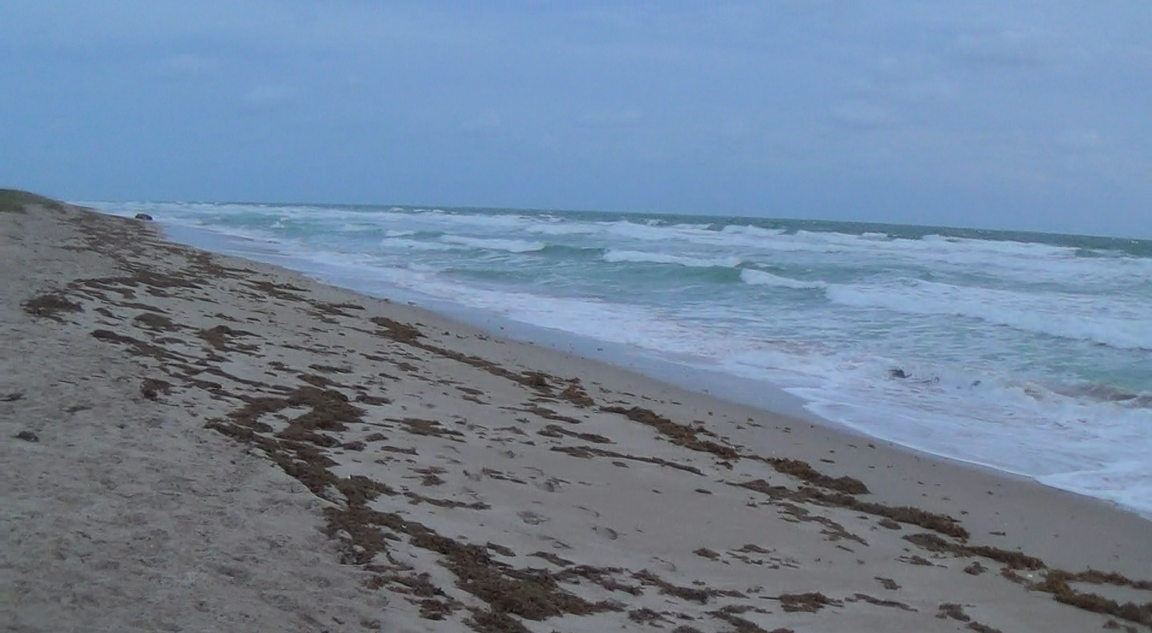
The beaches seem to look very similar from South Hutchinson Island up to Sebastian.  There are a few small scallops but no cuts to speak of.   There is also a lot of sea weed at the top of the sloping sand beaches.

Wabasso Beach Yesterday Afternoon.
Turtle Trail Yesterday Afternoon.

Alberto said Seagrape looked the same as the other beaches.

Thanks for the photos Alberto!

The waves have been hitting from the east for quite a while without any nice angles.

I was ready to go out this morning but had a low tire to tend to.

---

Every once in a while one of my old posts is discovered and read by tons of people.  The one that was being heavily accessed the past couple days is the one about Treasure Coast sea shells with calcite crystals.

https://treasurebeachesreport.blogspot.com/2015/05/52815-report-unique-beach-treasures.html

I assume a link to that post was posted somewhere else.  Even more rare and interesting in my experience is the fossilized bone containing calcite crystals.

Fossilized Bone Containing Calcite Crystals.

That goes right along with what I've been saying about being a complete beach hunter - not just a detectorists.

There all kinds of treasures to be found on the beaches.  They can be millions of years old and very rare and interesting.

---

Source: MagicSeaWeed.com.

As you can see, we're going to have more high surf.  Hopefully we'll get some good angles or the water will hit the dunes somewhere.

Tropical Storm or Hurricane Leslie is still hanging around out there.

Happy hunting,
TreasureGuide@comcast.net

Wednesday, September 27, 2017

9/27/17 Report - Lost Gold Ring. Jupiter Beach to Cocoa Beach. Shoreline Changes, Obstacles, and Special Opportunities.


Wtitten by the TreasureGuide for the exclusive use of treasurebeachesreport.blogspot.com.

Jupiter Inlet Beach.
Photo by Joe D.
Joe D. sent me these photos along with the following message.   

After just reading today's post, we have similar conditions here! In fact the beach has added 2-4 feet in places! Same problem; tons of seaweed and a mushy beach all the way up to eroded dunes! Waves from the east and little wind, even though it's large surf! All targets were light aluminum trash!
Some of pics are near same spots as I sent a few weeks ago so you can see the addition of sand
Looks like it will take a few week to normalize!


Joe D.

Thanks for the great photos and report Joe.  It does indeed look very much like the Treasure Coast.


Beach at Jupiter.
Photo by Joe D.
So what is it like just north of the Treasure Coast?  Dan C. sent the following.

... I have been hunting mainly Cocoa Beach due to its convenience -proximity to Orlando.
The post Irma hunting was good , meaning at least one gold find per 5-6 hour hunt.
The Post Maria hunting is not good.
You mentioned seaweed in your recent blog.
Actually, in the case of Cocoa Beach, it is about 80-90 percent Mangrove roots and branches, mixed with some seaweed.
Where did all these tree roots come from ? Indian River ? FL. Keys ? Bahamas ?
It would be kind of interesting to know where this stuff originated.
Or perhaps it is some variety of trees that grow in the dunes....... hard to tell as they are so pulverized, but the stumps are multi branched, the roots are short and fat.
There is enough of it to fill a dump truck for every 100 feet of beach.
It has formed clusters where it holds the sand, even in the wash zone- the waves don't break it up.
So, today hunted from 4 am to 930 to catch the low tide.
A few shell piles were formed close to the waters edge, produced nothing.
The shell line produced one stainless ring, one silver/enamel tiny pendant, one fake earring, a silver toe ring.
Higher up on the beach, I can see about a foot of new sand since last week, which came from Maria. I know it's at least a foot since it is full of those branches/roots even down deep.
Basically it's now all sanded in. Very little in the way of targets, even trash.
Perhaps if I can catch a flat day I will try a water hunt next.


Take care,
Dan in Orlando.


So these clumps of whatever are to be found at least from Jupiter to Cocoa. They were heavy on the Treasure Coast beaches today.  I also wondered where they came from.  Maybe we have a marine biologist or someone that can tell us.

On the Treasure Coast the biological materials, whatever they are, were catching sand and shells and in some cases being covered by sand.

One thing I should mention, and I haven't lately, is that when I talk about beach detecting conditions, I'm usually talking about finding shipwreck cobs and treasure coins.  I used to say that often and make it clear when I was giving a numerical beach conditions ratings.  At other times I might not always make that clear.

There is a correlation between beach conditions for finding old shipwreck items on the beach and finding more modern items, but the correlation isn't perfect.  Very old things surface less often than things that are just years or decades old..

Also when I give a rating or talk about beach conditions, I'm talking about general conditions.  I'm most often talking about those stretches of beach that produce shipwreck coins when the conditions are right.  You shouldn't forget, though, that when overall conditions are not great, there can still be small nooks and crannies where there is a chance to find something very good.  Often those places are beside a sea wall, jetty, rocks or foundation or something that provides an obstacle and opens a small pocket.  You might want to look around for some of those nooks or crannies.

Historic Shoreline Changes Around Present Day Fort Pierce Inlet
Source: marine.usgs.gov/coastalchangehaardsportal/
Here is the color key that goes with that.


Dark blue indicates the shoreline in 2012, and dark orange indicates the shoreline in 1830.

First you'll notice that the inlet was not open in the early 1800s.  The orange and yellow lines indicating the shoreline goes right through the inlet.

One thing I want you to see is that the shoreline north of the inlet has been moving out while the shoreline south of the inlet has been moving west.  They have tried to stop the erosion to the south of the inlet in recent years by dumping new sand there every year. Obstacles, like the jetty, large or small, disrupt the flow of sand and create what I call special opportunities.

There are some important lessons you can get from this illustration.  One very general principle is that when sand accumulates in one place, it leaves another.  That seems very obvious, but a lot of people don't appreciate the importance of that.  When sand builds one place, always ask yourself where it is coming from.  It is good to find where the sand is coming from and check where the sand is leaving.

You might have noticed that I posted some old wood finds since Irma hit our area.  There was the sheave and some other pieces.  That tells you something if you think about it.  Why did that old wood suddenly show up after all that time?  It was uncovered.  Where?  It could be from the beach, but we have not seen much beach erosion, or it could have been uncovered in deeper water and floated in.  Again stating the obvious, wood floats and therefore can travel very quickly and far once it is uncovered.

There is a lot to think about.  I'll stop there for today.

---

I just wanted to add this as soon as I found out.  Someone just reported that they lost a gold Claddagh wedding band in the John Brooks or Frederick Douglass beach area. Please help get it returned.

Thanks much.

---

Happy hunting,
Treasureguide@comcast.net

Thursday, May 18, 2017

5/18/17 Report - 19 Tons of Silver Bars. Some Erosion on Some Treasure Coast Beaches.


Written by the TreasureGuide for the exclusive use of treasurebeachesreport.blogspot.com.

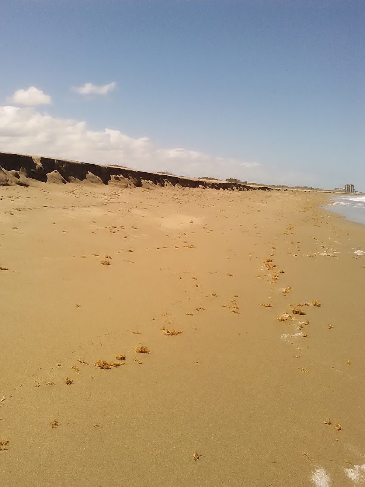
Eroded Treasure Coast Beach As Seen Early This Afternoon.
I noticed a good southeast wind once yesterday and suspected there might be some beach erosion.  I got out today and did find some.

The above cut is about two feet high.  As you can see, there is a lot of seaweed.  The sand in front of the cut was mushy.  The seaweed undoubtedly washed up after the wind changed direction and the erosion was done.

The quick erosion and refilling happened a number of times during a few weeks a month or two ago.  No cobs showed up then either.

Another Beach With Some Erosion. 
There was not quite as much erosion here.

No Erosion at The Third Beach.
The third beach had even more seaweed.  You could also see where the sand was accumulating on the front of this beach.

Overall, I'd say beach detecting conditions are not good despite the erosion at some beaches.

---\


I previously talked a little about the S. S. Gairsoppa, but did you know about the SS Mantola?

Odyssey Marine Explorations has filed to claim salvage rights for the SS Mantola, a ship that was carrying nearly 19 tons of silver bars when it was sunk by a German torpedo in 1917.

On May 1 an court order was issued giving Odyssey exclusive rights to salvage the wreck.  The order in part reads,  ...IT IS ORDERED that Plaintiff's Motion for a Preliminary Injunction temporarily enjoining and restraining any and all interference by any third-parties with Plaintiff's rights to salvage the shipwreck site located within the area defined by the center-point coordinates is hereby GRANTED; it is further ORDERED that nay and all third-parties are hereby enjoined from conducting search and/or recovery operations, or conducting activities which would disturb the shipwreck site in any manner or that would interfere with Plaintiff's rights to continue its recovery of the cargo and artifacts at the shipwreck site;...

Any other parties have the right to submit their claims.
The coordinates for the wreck were kept secret, but it is known the the Mantola was discovered not far from the Gairsoppa.

The company ( Odyssey ) estimates 536,000 ounces of silver could be on board the ship. Under a 2011 salvage agreement with the UK government, Odyssey was to keep 80 percent of the cargo.
However, that agreement lapsed in September 2015 and the government no longer makes such deals, the suit says. Odyssey is staking its claim for ownership.
Here is the link to that source, where you can find some additional information.
And here is the link if you want to find out more about Odyssey's Mantola project.

http://www.shipwreck.net/ssmantolafaqs.php

---

Happy hunting,
TreasureGuide@comcast.net


Wednesday, April 12, 2017

4/12/17 Report - Rare Four-Reale Expected To Sell For Nearly Five Thousand Dollars. Recent Cuts on the Treasure Coast. Ghost Ship.


Written by the TreasureGuide for the exclusive use of treasurebeachesreport.blogspot.com.


Source: See link below.

Here is one of the higher priced reales in the current Sedwick auction.  Said to be a rare variety, the auction estimate is $3500 - $5000.

Here is the lot description.

Lima, Peru, 4 reales, Philip II, assayer R (Rincon) to left, second denomination o-iiii to right, motto PL-VSVL-T, legends HISPA / NIARVM, extremely rare. S-L1; KM-10.1; CT-311. 12.45 grams. Broad flan with nearly full legends, bold full pillars and shield (the latter slightly doubled, slightly porous XF+ with nicely toned fields, full secondary denomination o-iiii to right of shield, a near-unique variety of which we have only ever seen one other (the Sellschopp and Heiss Plate Coin we offered in Auction #18, curiously made from a different pillars-side die).


http://auction.sedwickcoins.com/Treasure-World-U-S-Coin-and-Paper-Money-Auction-21_as47083?p=1&ps=50&ca=860005&so=1&q=&hi=0&vm=1


---

John Brooks Beach Yesterday Afternoon.
Above is what I saw at John Brooks Beach yesterday afternoon.  Below is what I saw at Walton Rocks just a little later.


Walton Rocks Beach Yesterday Afternoon.
 There is a lot you can see on this beach.  Towards the top just in front of the dunes is a little cliff that was created back some weeks ago.

Down the slope a little farther was a recent cut.  You can see it just above the heavy line of seaweed.

Then of course is the sea weed, and just below that you can see where new sand piled up.

Below the recent cut would be a good place to look wherever the new sand hadn't accumulated much.  It would have been better to be there before the seaweed and sand came up.

You can often see where new sand fills in after a beach cuts.  This is a good example.

Yesterday I mentioned how John Brooks has been cutting every other week or so,  It has been cutting and filling over and over, but not into anything old.

---

A 110-year-old ghost ship was found on a tributary to the Ohio.

Interesting read.  Lots of pictures.

http://www.viralforest.com/110-year-old-ghost-ship-in-the-ohio-river/


---

Looks like the Easter coin hunt isn't going to be as good as expected.  The predictions now are for four to seven foot seas instead of five to eight as earlier predicted.  

Looks like the prediction models are up to their old tricks.

Happy hunting,
TreasureGuide@comcast.net


Wednesday, March 1, 2017

3/1/17 Report - Ancient Gold Jewelry Found by Detectorist. Distribution of Wrecks. How Natural Features Can Point You To Finds.


Written by the TreasureGuide for the exclusive use of treasurebeachesreport.blogspot.com.


Ancient Gold Jewelry Found by Detectorist


Mark Hambleton, who went back to metal detecting after advice from his late father, made the find with Joe Kania, on Staffordshire Moorlands farmland.


The three necklaces and bracelet are believed to be about 2,500 years old.


Their find was declared treasure at an inquest led by coroner Ian Smith, who joked it was likely to be "worth a bob or two"...


Here is the link for more about that.


---

Yesterday I was discussing an interesting dissertation on shipwrecks. I'll discuss that a little more today.

Below is a chart showing the distribution of wreck sites in the study.  Many were from the 1800s.

Notice the clustering.  I always say that things cluster, whether it is stars or microbes.  It is certainly true in many ways when it comes to shipwrecks and metal detector finds.

In this illustration you can see that the heaviest concentration is outside of the inlet on a sand bar.  That is certainly not surprising.  The there were also a good number in the inlet and port area.  There are also plenty to the north and south of the inlet, with perhaps more to the north.  Or is that accurate?  I'm not totally sure about that one.

My main point, and I won't get much more detailed today, is that there are reasons for things and patterns to be discovered.  It is easy to go out to a wreck and swing a detector around anywhere to see if there might be something there, but you'll do better if you do a little research and analysis.

Towards the end of the dissertation you'll find a variety of wreck photos showing how wrecks deteriorate over a period of years and how they are repeatedly exposed and covered again.

Here is an interesting one.

Part of Wreck Partially Exposed.
Notice how the structure blocked wind, slowed sand and resulted in a small dune.  Again, there are reasons for things.  If you see a dune that seems to be out of place, you might wonder why it is there.  There is undoubtedly a good reason for it, and it could be a good clue.  Wrecks, like natural objects and other man-made objects can change the landscape.  I believe that some of the rocks along our shore cover shipwreck remains.

I use the same principle to find old bottles.  You see an isolated clump of moss or seagrass sticking out of submerged flat sand.  There is a reason the grass is in that one spot.  Sometimes it is growing on a rock or a log, and sometimes it might be growing on an old bottle.  My favorite bottle find came from investigating such a clump of vegetation.

I'd encourage you to browse through this dissertation for yourself.

I found it at I found the dissertation on https://oaktrust.library.tamu.edu.

I'm sure you'll be able to find it using torres-dissertation-2015.pdf.

---

The surf is running two to three feet.  We are going to have some good negative tides.

Expect a nice bump in the surf this weekend - perhaps up to seven feet.

Happy hunting,
TreasureGuide@comcast.net


Sunday, November 15, 2015

11/15/15 Report - Current Treasure Coast Beach Detecting Conditions and Predictions.


Written by the TreasureGuide for the exclusive use of treasurebeachesreport.blogspot.com.


Treasure Coast Beach This Morning.
As you know, we've been having a lot of wind and some waves.  I went out to the beach this morning to check it out.  I didn't expect much, and that is what I saw - not much.

Usually it takes up to six or eight foot seas to really improve conditions, but there are other factors involved.  The direction of the waves is very important, and the tides have an effect.

This time we had a brief period of north wind yesterday and then it turned.  The waves this morning were hitting directly from the east.

The first beach I visited this morning is shown above.  Nothing but some shallow scallops.  The water had been up fairly high, but no erosion on this beach.

Another Treasure Coast Beach This Morning.
There was no erosion at the next beach I visited except for one small stretch.  The cut there was less than a foot high and not very long.

Note the sea weed.  That is an indication of accretion, not erosion.

Small Cut.
This small cut evidently occurred during a previous high tide before the wind changed.  The sea weed in front of the cut shows that after the cut was created and the wind changed, it started to fill again.

Small Boat Washed Up Onto Beach
At least we've been getting some rough water lately. October and November have traditionally been pretty good months for detecting.  We often get some of our first storms then.

We need to get back down to the sand levels we had back a few weeks ago and then some.

The next few days we're supposed to have 3 - 5 foot surf.  On Wednesday it is supposed to be a bit higher, maybe up to seven feet.

If the wind direction stays as predicted, it won't be good.  Nothing but east and then southeast winds.  I'm not expecting much improvement in beach conditions from that.

I'm sticking with a 1 rating on my Treasure Coast Treasure Beach Detecting Conditions Rating Scale. I'll hope for something better but am not expecting it.

If you scout around some you probably be able to find some small cuts and slightly better spots.

I have some pictures of my favorite finds from my trip up north ready to show.  I'll probably do that tomorrow.

Happy hunting,
TreasureGuide@comcast.net


Monday, May 11, 2015

5/11/15 Report - Treasure Coast and Other Florida Beach Conditions. Good Ships and Travel Web Site.


Written by the TreasureGuide for the exclusive use of treasurebeachesreport.blogspot.com.

Jensen Beach This Morning Near Low Tide
This photo shows a beach where some sand has moved.  At the bottom of the picture note the dip in the shallow water.  At the top left, note the sand bar.

The light sand between the two people (one is just a white dot) at the top left is where the sand was scooped out to form a shallow cut.  You would expect to find coins there.

That sand got washed into the water to add to the sand bar.

These days I'm happy to see features like those.  It means that things at least got shifted around a little.

You can easily read a beach like that and know where to spend your time.

Jensen Beach Looking South
The second photo was taken from near the same spot only looking the other direction.  There are not as many interesting features in that direction.

Another Beach On South Hutchinson Island
Here is another beach.  It was featureless.  I much prefer to hunt a beach that has distinct features.

That photo also shows where someone got married this weekend.  May and June is a time for a lot of beach weddings.

While our beaches are only producing modern items, I keep hearing about the St. Augustine beaches and the beaches up a little farther north where Ana caused some erosion.

Here is a good article on St. Augustine's disappearing beaches.

http://www.gulflive.com/news/index.ssf/2015/05/florida_coast_sea_rise_threate.html

Ana was the earliest tropical storm since 2003.

http://hosted.ap.org/dynamic/stories/T/TROPICAL_WEATHER_ANA?SITE=AP&SECTION=HOME&TEMPLATE=DEFAULT&CTIME=2015-05-09-06-21-18

It looks like there were good crowds on the Treasure Coast beaches for Mother's Day.  I hope you and your family had a good one.

Mother's Day has a surprisingly complex history.

http://news.nationalgeographic.com/2015/05/150507-mothers-day-history-holidays-anna-jarvis/

Here is an interesting web site that you might want to take a look at - Ships and Travel in the 18th Century

http://www.iro.umontreal.ca/~vaucher/History/Ships_19thC/


I ran into a good coin hole this morning.  Lots of coins.  Only one piece of gold though.

I define a coin hole as being roughly oval shaped, while a coin line I would say would be at least five times longer than wide.

The coin hole that I found this morning was on a convex beach front near the water.  It wasn't the most obvious spot.  Shells were just under the sand.

I'm not expecting anything for the Treasure Coast other than a one or two foot surf for a couple of days.

Sea Weed On Bahia Honda
Photo submitted by Dan B.
Thanks for this photo from the Keys Dan.  Seaweed like that can be a pain if it is where you want to detect, but you can sometimes find things tangled in seaweed such as dollar bills or chains.  It is worth looking.

The good thing about reading about the erosion up north is that it reminds me that it is only a matter of time until we finally get ours.

----

I heard from some people interested in the opportunity I announced yesterday concerning diving on the 1715 wrecks with Captain Jonah.   If you didn't see that, you might want to go back and take a look, but the captain will be doing the selection and you need to contact him at the phone number provided.  Read it carefully before calling.  This is for one full time position.

---

Happy hunting,
TreasureGuide@comcast.net