Showing posts with label beach erosion. Show all posts

Tuesday, March 6, 2018

3/6/18 Report - Understanding Why Big Waves Sometimes Lead To Finds and Other Times Not. Mystery Find Identified.


Written by the TreasureGuide for the exclusive use of treasurebeachesreport.blogspot.com.

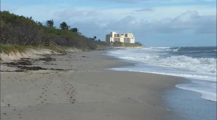
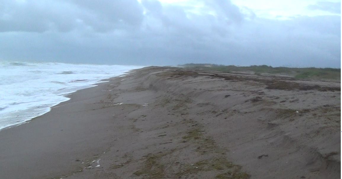
After all of the big surf the past few days, there was more accretion than erosion along the Treasure Coast.  I talked about a couple of the reasons for that yesterday.  I mentioned the amount of sand in front of the beach that was absorbing most of the wave energy before the waves hit the beach, along with the angle of the waves.

You've probably heard of the legendary Thanksgiving Storm or 1984.  I've mentioned it several times before and I posted the exciting story of one person that was there that day.  I also posted a NOAA report that explained why that storm damaged the beaches so much.  While people are wondering what happened and why the recent waves didn't do much for us, I thought it would be a good time to post some of that report again.  It really explains what happened back then and why it happened.

Here is part of that NOAA report.

...The meteorological conditions just described produced one of the most damaging storms to affect the eastern coastal sections of Florida during the past several decades. Much of the damage from Fernandina Beach southward to North Miami Beach, nearly 400 miles, was caused by the easterly winds of gale force with gusts as high as 60 miles an hour blowing for nearly four days. This action of the wind over the ocean produced shoreward moving swells of around 20 feet which pounded the Florida east coast and produced the most severe beach erosion in recent years in many areas. An example of the destruction was the reduction of the newly completed l100 foot pier at St. Augustine to 300 feet. Sand dunes were obliterated leaving barrier islands void of any natural protection against the next onslaught of a coastal storm in the future.To add to the destructiveness, the highest monthly astronomical tide period coincided with the highest period of storm tides which occurred on the morning of Thursday and Friday, the 22nd and 23rd. All of this produced tides 4 to 6 feet above mean yea level (MSL} at times of high tide. In some places, this was the highest tide in the last 30 years. Alt Mayport, Florida, just north of Jacksonville, the tide of 5.2 feet above MSL was the third highest tide of record. Much of state road A1A, the famous coastal highway, was closed in Indian River County between Vero Beach and Sebastian Inlet because of high water. In this area several beach front buildings collapsed, and 600 to 1,000 people were ordered to evacuate their homes. In Palm Beach County, five blocks of A1A were seriously damaged by the high tides and heavy surf. Bridges were closed because of flooded approaches which caused some barrier islands including the large Hutchinson Island to become isolated for periods of time around the time of high tide. In the storm's aftermath, severe coastal beach erosion stretched from Jacksonville to Palm Beach. ...

At the West Palm Beach weather office, a new station rainfall record was set on Thanksgiving Day for the greatest amount in a calendar day, 7.41 inches....

Another factor was that these strong onshore winds continued for many days. Winds of near gale force (about 40 miles an hour) began blowing along the north Florida coast the evening of the 20th. They did not subside until late on the 24th. Therefore, much of Florida experienced strong onshore winds for about 4 whole days. These winds were frequently between 30 and 40 miles an hour. The direction of the winds was from the north northeast which is probably the best angle of incidence for beach erosion along the coast from Fernandina Beach to Palm Beach. The coastline south of Palm Beach was spared from most of the adverse effects of the storm because the wind was actually blowing offshore throughout much of the storm. However, this northwest wind caused significant damage to the coastlines of the western Bahama Islands Friday and Saturday. This was all due to the position of the storm center remaining over Grand Bahama Island from early Thursday morning through early Saturday...

As noted earlier, the time of the month that the storm occurred was coincident with the highest astronomical tides of the month and nearly the highest spring tide of the year. Tide tables indicated that the highest predicted tides for the month of November fell on the mornings of the 22nd and the 23rd, exactly during the time of the highest storm tide. Reports from the storm survey teams of the Florida Department of Natural Resources indicate that the storm tide was over 6 feet above low mean water. Tide gauge readings at Mayport were 7.5 feet above mean low water or 5.2 feet above mean sea level. The one factor of the storm episode which magnified the entire situation was the nearly stationary nature of the storm for 3 days. This lack of movement produced the prolonged onshore winds which resulted in at least 4 days of heavy surf pounding the shore. Portions of the coastline experienced 9 high tides during this period, with each succeeding high tide higher than the previous one, thus making the erosion of sand greater with each tide. These are the reasons for the extensive damage that resulted from this particular storm....

Before commenting, here is the link if you want to read the entire report.

http://www.srh.noaa.gov/images/mlb/pdfs/Nov_1984_storm.pdf 

Notice that the report says,  The direction of the winds was from the north northeast which is probably the best angle of incidence for beach erosion along the coast from Fernandina Beach to Palm BeachAs is often the case, the wind has been shifting the past few days.  It started from the north and one person said they saw some cuts (Saturday I think it was), but they disappeared a day later.  Often that is what happens when a front moves through: the wind shifts around as the front moves through.  As the direction changes the swells change and the sand moves one way and then another. 

Unfortunately we're going to continue getting changes in wind direction as another front moves through.  However, I'm still thinking the biggest problem is the tons of sand piled up in front of the beach. 

Knowing when and where to go isn't an exact science.  You can learn enough to improve your chances considerably, but there will still be hits and misses.  If you get it right every time, you're a lot better than I am.  I go out to check to see what is happening.  Sometimes I'm surprised and sometimes I see exactly what I expected.  If you go out after a long period of south winds and small surf, your chances of finding any old treasure coins is very slim.  As with many things, learning is a matter of probabilities.  In fact I say that skill is a matter of doing the things necessary to improve the probability of success.

I don't know if I've ever said this before, but I believe that heavy rains can add a little to erosion by agitating the top layer and cliff faces.  I have no idea how significant that might be, if at all.

I think the NOAA report on the Thanksgiving Storm is worth studying.  It tells you what caused one of the most legendary treasure beach days ever.

One factor they do not address is the longer term changes that occur over years or decades.  It seems to me that there are times when you have net erosion or accretion that occurs over a period of years.  I can remember times when that big sand bar was not in front of John Brooks beach and if you stepped off the front of the beach into the water there was a drop off.  There were pot holes right in front of the beach.  The bottom wasn't covered with a layer of sand.  That lasted for some years, but it hasn't been that way for at least a few years now.  In my opinion, that has a lot to do with why John Brooks has not been too productive in recent years.

---

We have consensus on yesterday's mystery find.  Lloyd D., Joe R., William M. and Bill P. all said it is a sheet music holder.  Thanks guys. 

No other ideas offered, so I think that is it.  Below is an example from Pinterest.


The holes were for attaching the shelf and some of them had other attachments for holding the sheet music firm, which explains some of the other holes.

The interesting thing would now be to see if there is a story behind it and how it ended up where it was found.

----

Happy

Sunday, December 10, 2017

12/10/17 Report - Ole Timer Talk: 10 Different Gold Items One Short Hunt.


Written by the TreasureGuide for the exclusive use of treasurebeachesreport.blogspot.com.

I've posted a few Ole Timer Talk pieces in this blog, but haven't told any of my experiences that way.
A few came to mind last night.  I've referred to parts of those experiences to illustrate some things I wanted to explain, but I haven't described them as completely as I could.

The experience I'm going to talk about today happened on an otherwise normal day about thirty years ago, so I'm sad to say that I forgot a lot about it.  That is mostly why I haven't told it this way.  Fortunately I have some written records to refresh my memory and help me get the most important parts right.

My records were scribbled in cursive with a lead pencil.  The paper is now old yellow crinkled tablet paper.  The entries are labeled with the month and day, but not the year.  That was a big mistake that didn't seem like it would be a problem at the time.

One sunny day near low tide in early February I arrived at a beach that I detected frequently back in those days.  I don't recall any, people on the beach, which is kind of strange for a nice day down south, so I would guess it was early morning.  The parking fee there was something like four dollars, so people mostly parked elsewhere if they could.  There were no other detectorists there.  That I know for sure.

The surf must have been calm.  I don't remember it being an issue at all.

I was in South Florida and was targeting modern jewelry in those days.  I had a few years of detecting under my belt, but was not much more than what I would consider to be a beginner.  I was using a Fisher Aquanaut 1280 at that time, I think.  Maybe I had started using a modified Nautilus.  I'm not sure about that.

When I arrived at the beach, I noticed a good bit of erosion.  It wasn't what you usually see.  The erosion was right at the front of the beach.  There was no slope between the cut and the water.  The cut was right at the waters edge.  The front of the beach had been cut back and the sand spread out in the shallow water.  Very often there is a cut farther back on the beach and then a slope down to the waterline.  In this case the cut fell off into the water.  It was more like the beach had been moved back a few feet.
Red angular line shows surface after erosion.
Grey line shows target distribution.

I stepped over the cliff and into the very shallow water.  It was only up to my ankles or lower leg.  I mostly hunted in shallow water back then.  I moved my coil.  Bingo.  Good target on the first swing.  I dug it up.  Blackened coin.  Without moving on, I took another swing,  Bingo again.  Another blackened coin.  There were targets everywhere.  I'd say every square foot had a target.  In the next four hours of the hunt, I picked up twenty dollars in quarters alone.  I remember telling somebody (Kevin Reilly) that, which is why I remember that number.  But it wasn't only coins.

The targets were not deep - at least not the ones I was digging.  I don't remember digging any big holes.  I didn't get around to that.  There were so many targets that I never got to the deeper ones that day, if there were any.  

I don't know what the total face value of the blackened coins was that day, because  I only recorded the nice jewelry finds and the general location.

Below is what my notes show for that day.  The notes are pretty much as they are written, although they were scribbled and not real easy to decipher.  Maybe that was intentional. 

2/4 -  at North picnic area below new play equipment - blue star sapphire ring, 2 gold ear rings,"SC" signet ring, and 10k band in water  Also silver double heart ring.

2/4 - middle picnic area just south of walkover -  14 k black pearl and diamond ring, also silver and turquoise ring.  In water.

2/4 - south picnic area by life guard station by turtle cage in water - silver love knot ring, silver and turquoise ring, gold religious charm, 2 class rings, 1 14k band.

What I recorded for that four hour hunt was 10 pieces of gold jewelry.

I left after about four hours.  I don't know why I left (maybe I had to do something), but I'm sure I dug less than 20 percent of the available targets in the area that day.  I was going to return the next day, and I did.  I have a couple entries for 2/5.  

I didn't record how many coins I found.  When I first started metal detecting, I recorded the number of each denomination of coin that I found.  From those records I knew when my Aquanaut paid for itself in clad coins, which it did in one year.  It cost me something over $600 for the detector, if I correctly recall, and I knew when I found enough change to cover the cost of that detector.

If I encountered the same situation today, I would do some things differently.  First of all I would try to hunt as long as it took to clean the area of all targets.  If for some reason I couldn't do that, I would  try to cherry pick the gold.  At the time I didn't have the skill to do that very well.   I'm sure the second approach would have meant missing some gold because the target density was so high.  You'll find more than you think after you clean out a lot of the louder targets, so the best practice would have been to spend the time to clean it all out properly even if it took more than one day.  Problem with that is that you never know when conditions will suddenly change and it all disappears.

As an aside, the only problem I ever had with the 1280 was, after I first got it, I kept breaking the plastic things that the upper forearm fit into.  They finally sent me metal ones to replace the plastic ones.  It was very reliable.  Fisher did a tune-up on it for me once.  I sold that detector after a few years and got nearly the purchase price for it.

I'm glad I have my records for that hunt.  They helped refresh my memory so I could tell the story.  It was a long time ago but a time to remember.

It s funny how some details stick so vividly in memory while other fade.

The second day I don't remember as well and my records do not seem to be as complete, but I do have entries showing an 18k charm, a crucifix with gold chain, a 10K band, a Jesus and Mary medallion, and a 14k nugget band.  I don't know what other coins or what else was found.

The one big thing I remember about the second day, and I remember it very clearly, is the end.  As I walked back to the car I looked up and noticed a weather front coming in.  A thick layer of clouds was arriving from the north.

The next day I returned to the same spot, and quickly found that it was all over.  No more targets at all.   It opened up suddenly and closed just as suddenly.  That is the way it goes, and why it is so important to make hay when the sun shines.

---

The cold front definitely arrived to the Treasure Coast.  The wind has been out of the west and north. We have some nice cold air.  The surf is small.

Happy hunting,
TreasureGuide@comcast.net


Thursday, October 19, 2017

10/20/17 Report - Diamond Earring Lost. Jupiter to Juno Beaches. Hurricane Ophelia Uncovers 1500-Year-Old Remains On Beach.


Written by the TreasureGuide for the exclusive use of treasurebeachesreport.blogspot.com.


Hurricane Ophelia caused erosion and uncovered some very old things - not on the Treasure Coast but in Ireland. The Irish Post reports the 1500-year old skeletal remains shown above being uncovered on an eroded beach.

Here is the link for more about that.


---

Joe D. sent the following photos of the Jupiter to Juno beaches.  Excellent photos Joe!  Thanks much.

Photo by Joe D.

Photo by Joe D.
You might have notices how similar these beaches are to those of Hutchinson Island that I showed yesterday.  The beach shape is about the same: fluffy convex slope with flat front.  Also note the sea weed, which is common to the other beaches.

Photo by Joe D.

Photo by Joe D.

Photo by Joe D.
---

I received an email from a fellow whose wife lost he diamond ear ring in the water near Juno.  That would be a very tough find now with the rough surf, but if anyone wants to give it a shot, I'll try to hook you up with the fellow for more details.

---

I also heard from a fellow who is looking to hook up with some hunting buddies in the Loxahatchee area.  George said, ...was wondering if there are any groups that hunt the Florida beaches. I picked up a new detector (AT MAX) and would like to find a hunting buddy. I am in Loxahatchee.

If interested you can contact Geroge at gtbehary@gmail.com. If you are in a club, you might want to contact him about meetings.

---


On the Treasure Coast Friday you can expect more of the same.  It will be a 4 - 6 foot surf with an east/northeast swell.

Happy hunting,
TreasureGuide@comcast.net

Wednesday, October 4, 2017

10/4/17 Report - Beach Erosion and Conditions. Jupiter Beach. Musket Balls and Lead Shot Finds. Nine or Ten Foot Surf. PM Update.


Written by the TreasureGuide for the exclusive use of treasurebeachesreport.blogspot.com.

Seven Foot Cliff At Fort Pierce South Jetty Park Yesterday Afternoon.


Most of the sand they dumped here a couple of months ago is almost gone.  It is all renourishment sand.  That doesn't mean there can't be something old in it.  I showed one WW II hat emblem that I found in renourishment sand there once.  It depends upon where the new sand came from, and I don't know where that is, although I think it is from near the south bridge in the river.

Fort Pierce South Jetty Park Looking South Tuesdsay Afternoon.
You can't see it in the picture, but there was a detectorist working the slope at the bend.  That is the an area I mentioned once as producing a lot of WW II dog tags.  It is also not far from an old wreck that is believed to well picked over.


Frederick Douglass Park Looking South Yesterday Afternoon.
As I said yesterday, the water was high and getting back over the berm, but there were no cuts or other erosion at John Brooks or Frederick Douglas Tuesday afternoon.  I suspect most erosion will be around barriers or obstacles such as rocks, jetties or erosion control structures ( irony ).

I was going to take a picture at John Brooks too, but the rain started pouring down and I couldn't get the picture.  It turned out to be so much like Frederick Douglass that it wasn't necessary anyhow.

---

Joe D. sent the following report from Jupiter.

South of inlet conditions are pretty much unchanged! Worked a little farther south past the renurished beach and did find a small coin line along a small cut that had formed from morning high tides! Hoping the King Tides will create a few more cuts since the wind and waves are making low tide hunting unavailable awhile!

Thanks much Joe!
---

I showed a lot of lead and musket ball Irma finds.  In one other post I mentioned the following web site that was referred to me by Trez.

http://woodsrunnersdiary.blogspot.com/2016/04/more-on-small-shot-for-smoothbores.html

If you do some research, you'll find that musket balls can be tell you a lot.  Don't just look at them as round balls of lead even though that is what they look like.

The size can tell you a lot.  You can find tables that tell you the size to be used for different types of wild game, for example.  One size is recommended for pigeons and another size for ducks and another size for geese.

The size can also tell you something about the type of gun.  Smaller sizes were used as buck and sometimes shot with larger size balls.  The next larger size would be used for pistols, and then carbines and muskets.

You can find tables giving the size and weight of lead shot recommended for both different kinds of wild game and different fire arms.

By looking at the examples I've posted the last few days, I think the musket balls were being made at a camp on the beach.  Any spare lead could be melted and poured into molds.

Here are a couple links to start, if you want to learn what you might be able to tell from musket balls, or perhaps more properly, lead shot.

http://www.rubiconheritage.com/2011/12/16/biting-the-bullet-the-archaeology-of-musketballs/

https://finds.org.uk/database/artefacts/record/id/266828

The PAS finds database is a good resource.  Too bad we don't have something like that in Florida or the U. S.

---

There was a time when everyone would be eagerly hoping for a nine or ten foot surf.  Now after the hurricanes and big surf that brought very little erosion, it seems that a lot of people are discouraged, but even without big cuts and erosion this is still better than the continual summer south winds.  It gives you a chance, and at any time a window of opportunity could open up.  I'm rating Treasure Coast beach detecting conditions as a 2 on my 5 point scale.  It is far from excellent, but certainly better than those boring summer conditions.  Some old things will be found.

Here is the Wednesday prediction summary.


I love the windy rainy weather.  I guess I associate it with some of the better hunting days of the past and for me it is a lot better than the hot beating sun.

---

One day remaining to respond to the blog poll.  Shortly after that one, there will be another blog poll to follow up.

---

PM Update

I took a look at John Brooks, Frederick Douglas and Waton Rocks and saw very little change in any of the beaches from yesterday.  No cuts other than to the base of a few new front beach dunes in one case, and some renourishment sand near the back of the beach in another case. 

It looked like a the first two beaches might have a flat spot near the waters edge.  There seems to be a wide sand bar in front of those beaches.  Maybe it will separate from the beach a little at low tide.  I still feel a few old things will be found on the Treasure Coast.  I thought there were some spots worth checking out even if they weren't terribly exciting.  I have not seen and have no reports from Vero/Sebastian yet.


Happy hunting,
TreasureGuide@comcast.net


Tuesday, April 4, 2017

4/4/17 Report - Ship Remains Dated to 17th Century. Complexities of Beach Erosion.


Written by the TreasureGuide for the exclusive use of treasurebeachesreport.blogspot.com.

Jupiter Beach.
Jupiter Beach, as you can see above, has tons and tons of new sand.

Thanks to Joe D. for the photo.

---

Uncovered Ship Remains Buried Near Alexandria Virginia.
Source: See WTOP link below.

... Skolnik said some of the earliest tree rings from the ship are from 1603 — four years before John Smith showed up in Jamestown and 17 years before the Pilgrims showed up in Massachusetts.
“So the wood in the ship comes from a time of early American history that even predates the earliest permanent English settlements here in the New World,” he said.
But the ship was sunk on purpose by early Alexandrians.
He said documentary records show between 1788 and 1796, the ship went from being a vessel to being buried...
Here is the link for the rest of the article.

http://wtop.com/alexandria/2017/04/uncovering-mystery-behind-alexandria-waterfronts-18th-century-ship/slide/6/

They dated this ship by looking at the tree rings on the lumber.

Notice the number and size of the rods.

---

Yesterday I posted a list of ten factors that contribute to beach erosion.  Predicting erosion is complicated by not only the number of factors, but also how quickly those factors can change.  Furthermore, there are interactions.  For example, wave size interacts with tides.  Big waves are most effective when the tides are high.  So the timing of both factors as they relate to each other is important.

Water force is obviously the primary factor that causes sand and other items such as coins to move.  Many of the factors change the force of water at different locations.

The same force of water will move one type of object but not another, therefore you get separation or sifting of objects.

Erosion is a good sign and always present during the very best beach conditions, but beach old coins sometimes appear on the beach when there is no erosion.  I explain that more some day.

One complication is that the direction of water from an individual wave will wash up and then back down the beach, so the force of water from each wave changes direction.  Not only does the direction of the force change, but  the amount of force also changes as the wave goes up and down the beach. That might be obvious enough, but figuring out how the sand and other objects move is more complicated.

Another complication is that each wave interacts with other waves.  The outgoing water from one wave will hit the incoming water from the next wave.  The force from both waves is changed when they interact.  When outgoing water hits the incoming water from the next wave, temporary much of the force is lost at that point.

I'll continue with this some other day.

Here is a little puzzle.

Coins and other objects can actually move in the opposite direction of the water rushing over and around them.  Think about how that might happen.  I actually explained that once before.

---

If you have never seen the Northern Lights before, you might want to check it out.  For me, it is something that I'll never forget.

http://blog.spiritdaily.com/news-links/northern-lights-in-real-time

---

Yesterday the wind picked up in the afternoon and we had some good southerly winds.  I wish I'd get a chance to get out today to check out one of my spots that gets hit better by southerly winds.  Perhaps tomorrow.

We're supposed to get a cold front later this week.  It doesn't look like it will increase the surf though.

Happy hunting,
TreasureGuide@comcast.net

Monday, April 3, 2017

4/3/17 Report - Pink Star Diamond. Below Normal Hurricane Season Expected. Ten Factors That Determine Beach Erosion.


Written by the TreasureGuide for the exclussive use of treasurebeachesreport.blogspot.com
`
59.6 Carat Pink Star Diamond
Source: See Sothebys link below.

One of the world’s great natural treasures, the Pink Star diamond will lead Sotheby’s sale of Magnificent Jewels and Jadite in Hong Kong 4 April. Estimated in excess of US$60 million, this 59.60-carat oval mixed-cut pink diamond is the largest Internally Flawless, Fancy Vivid Pink diamond ever graded by the GIA. The sale of the Pink Star continues Sotheby’s tradition of bringing some of the rarest and most extraordinary collectibles to market.


http://www.sothebys.com/en/news-video/videos/2017/the-pink-star-a-true-masterpiece-of-nature.html


----

Experts are calling for a below-normal hurricane season this year, as a potential El Niño may limit the development of storms.

AccuWeather meteorologists are predicting 10 named storms, five of which are projected to become hurricanes and three of which may become major hurricanes. 


“The big factor is going to be the fact that we now believe El Niño will come on board some time during the summer and will continue all the way through the rest of the hurricane season,” AccuWeather Meteorologist Dan Kottlowski said.


Here is the link for more about that.

http://www.accuweather.com/en/weather-news/2017-atlantic-hurricane-forecast-possible-el-nino-to-limit-development-of-storms/70001271

---


When people talk about beach conditions, the two factors they typically talk about is high seas and the wind.  Other than those two important factors there are others that are important.  Here is a list of ten factors that determine how a beach will erode.

1.  Size of the waves.

2.  Direction of wind and waves.  This is actually relative to the beach and long shore currents.  On the Treasure Coast waves hitting from the north are best.

3. Tides.

4. Amount of sand or depth of water in front of the beach.

5. Where the waves are breaking.  This factor is determined largely by numbers 1, 3 and 4.

5. Timing.  High waves are more effective when the tide is also high, for example.

 6.  Obstacles such as inlets, rocks or sea walls.

7.  Duration of favorable wind, waves and tides.

8.  Type of sand or other material making up the beach and how it is packed.

9.  Beach saturation and pore pressures.

10.  Slope of the beach.

I also suspect that the wave periods may also have an effect.


---

The last few days have seen small surf, southeast wind.  There is no real changed expected very soon.  The tides are not as big now.

Happy hunting,
TreasureGuide@comcast.net

Saturday, April 23, 2016

4/23/16 Report - Treasures In Renourishment Sand. Jupiter Inlet Beach. Ring: How Old Is It? Dare.


Written by the TreasureGuide for the exclusive use of treasurebeachesreport.blogspot.com.

Big Cut South of Jupiter Inlet
Photo by John B.
T,his cut is in renourishment sand, but that doesn't necessarily mean there is nothing good in it.  Although it doesn't happen often, very good things can be found in renourishment sand.  WW II items were found in renourishment sand at Fort Pierce.  Silver U. S. coins were found in the renourishment sand at Ambersands not too long ago. Even Spanish galleon materials have been found in renourishment sand.  It is good to know where renoruishment sand is collected, and it can be worth checking renourishment sand.  There are times when there will be tons of old aluminum cans and other junk, but sometimes there will be things that are millions of years old.

Same Cut Showing Layers of Shells Etc.
Photo by John B.
Check the face of any cut to determine what might be in the sand.  In the photo above, you can clearly see some layers.

Thanks for the great pictures John!


Very Nice Shark Tooth
Find and photo by John B.
Here is what John said.  There was a pretty good cut along the beach just south of Jupiter inlet but it was all renourishment sand.  Lots of small iron junk targets, shells and shark teeth.    

That is a nice tooth.  Notice the serrations.

---

Yesterday I posted some items from the beach at Corrigan's.  That prompted Paul B. to send me the following email.

Hello, found this ring on one of the Ft. pierce beaches several years ago. I thought it was a more modern piece, but after looking at the pictures you posted today of the gold rings, now I'm not sure. It's silver with no markings and the stone looks as if it could be jade. What do you think? I'm attaching pictures.
Thanks,
Paul B.

Find and photo by Paul B.

What do you all think?  I have a hard time telling from photos.  Most modern rings would have a marking, especially if it is gold or silver.   

Paul provided a number of excellent photos.  Still there are some things I can't tell without actually handling.  It can be difficult enough even when having the item in your hand.

I'd appreciate any comments though.

---

The crew of the Dare is using Dolores (HAUV) to explore the deep mud at the south of the Atocha trail.

---

Happy hunting,
TreasureGuide@comcast.net

Sunday, December 6, 2015

12/6/15 Report - More Wind And Rain And A Little New Erosion. Billion Dollar Wreck of the San Jose Found.


Written by the TreasureGuide for the exclusive use of treasurebeachesreport.blogspot.com.


Above is what I saw this morning.  This beach had cuts of up to about two feet.  The front slope was unusually steep.  I've seen other beaches like that lately.

Most targets were near the bottom of the slope.  I found the same thing at a beach quite a few miles away yesterday.

I wouldn't be surprised if something interesting pops up somewhere, but from what I've seen I'm sticking with a 1 rating on my beach detecting conditions scale.

With all of the wind and surf we've had lately, you could easily expect more erosion.  The tides have been very flat though.  I was also noticing how there is still a lot of sand in front of the beach.

---
BBC has been reporting that Columbia has claimed that it found the San Jose, which has a treasure estimated to be in the billion dollar range.
The San Jose was discovered near Cartagena.  The wreck has been described as the "Holy Grail" of shipwrecks.
"Great news! We have found the San Jose galleon," the president tweeted.
The San Jose was carrying gold, silver, gems and jewellery collected in the South American colonies to be shipped to Spain's king to help finance his war of succession against the British when it was sunk in June 1708.
Here is the link for the rest of the story.

http://www.bbc.com/news/world-latin-america-35014600

---

I'm glad we've been getting a little weather.  The sand has been stirred up a little.  Hopefully there is more to come.

Only ond day left to respond to the blog poll if you did any detecting on the Treasure Coast the last couple of weeks of November.  I really appreciate your responses.

Happy hunting,
TreasureGuide@comcast.net

Friday, May 22, 2015

5/22/15 Report - Preserving Mining, Prospecting and Outdoor Recreation on Public Lands. Prehistoric Casino. Beach Erosion & Refilling.


Written by the TreasureGuide for the exclusive use of treasurebeachesreport.blogspot.com.


In the last few days I've received emails from different parts of the country including places as far apart as New York and California.

I  heard from a fellow that operates an organization that does the kind of work that is much needed.  The organization is called Public Lands for the People.  He didn't ask me for publicity, but I don't mind giving it.  I'd like to make sure our public lands are open for prospecting, mining and other outdoor recreation including metal detecting.

The organization received a treasure coin that they are going to auction and what he asked about was getting the coin authenticated.

You might want to take a look at the PLP web site.  Here is the link.

http://www.publiclandsforthepeople.org/public-lands-for-the-people-going-viral/

Sharon P. found what appears to be an antique fire hose nozzle. She did a lot of digging to get it.

Can anyone tell us if it is antique?

Find and photo by Sharon P.
She said she went back to the beginning of this blog and started reading through it.  Others have told me they are doing the same thing.  Nice find Sharon!

---

Prehistoric casino?

A cave on the shore of Utah’s Great Salt Lake is giving archaeologists a rare glimpse into a seldom-studied aspect of life in the ancient West — prehistoric gambling.
Researchers exploring the cave, known simply as Cave 1, have identified hundreds of dice, hoops, carved sticks and other trinkets used in indigenous games of chance and skill.
Based on what they’ve found so far, they project that there are more than 10,000 such items still waiting to be uncovered, making it likely the largest deposit of ancient gambling artifacts ever found in the western U.S.
Here is the link for the rest of the article.

http://westerndigs.org/dice-gaming-utah-cave-prehistoric-gambling/

---

Not too long ago I found an erode dune that had released a lot of coins onto the beach front.  The coins extended from the base of  the cut and down into the shallow water.  In the drawing the red indicates where the coins were on the sloped beach.
One day I returned to the same beach and it appeared that the water was lower.  It wasn't.  Instead of the water being lower the beach was higher.  The cut had filled in to a large extent.

The only objects that I found after the beach refilled were along the very base of the cut.  (Small red line.)  Those targets fell out of the face of the cliff after the beach had refilled, so they were found on top of the new sand.

That kind of erosion and refilling occurs over and over again.  Keep a mental record of the different levels of the beach as they occur.

As I've said before, stumps and rocks and other relatively stationary objects can help you gauge the coming and going of sand.

----

We've been having a one to two foot surf along the Treasure Coast.  The surf was very comfortable this morning near low tide.  Very easy water detecting, even if not good detecting conditions.  Both the beach and shallow water is sandy.

This weekend will be a busy beach weekend with the holiday on Monday.

The surf will increase slightly this weekend, and next weekend we'll have something more like a three to five foot surf for a few days.

That won't change beach conditions much, but even a slight shifting of sand will be welcome.

Happy hunting,
TreasureGuide@comcast.net

Monday, May 11, 2015

5/11/15 Report - Treasure Coast and Other Florida Beach Conditions. Good Ships and Travel Web Site.


Written by the TreasureGuide for the exclusive use of treasurebeachesreport.blogspot.com.

Jensen Beach This Morning Near Low Tide
This photo shows a beach where some sand has moved.  At the bottom of the picture note the dip in the shallow water.  At the top left, note the sand bar.

The light sand between the two people (one is just a white dot) at the top left is where the sand was scooped out to form a shallow cut.  You would expect to find coins there.

That sand got washed into the water to add to the sand bar.

These days I'm happy to see features like those.  It means that things at least got shifted around a little.

You can easily read a beach like that and know where to spend your time.

Jensen Beach Looking South
The second photo was taken from near the same spot only looking the other direction.  There are not as many interesting features in that direction.

Another Beach On South Hutchinson Island
Here is another beach.  It was featureless.  I much prefer to hunt a beach that has distinct features.

That photo also shows where someone got married this weekend.  May and June is a time for a lot of beach weddings.

While our beaches are only producing modern items, I keep hearing about the St. Augustine beaches and the beaches up a little farther north where Ana caused some erosion.

Here is a good article on St. Augustine's disappearing beaches.

http://www.gulflive.com/news/index.ssf/2015/05/florida_coast_sea_rise_threate.html

Ana was the earliest tropical storm since 2003.

http://hosted.ap.org/dynamic/stories/T/TROPICAL_WEATHER_ANA?SITE=AP&SECTION=HOME&TEMPLATE=DEFAULT&CTIME=2015-05-09-06-21-18

It looks like there were good crowds on the Treasure Coast beaches for Mother's Day.  I hope you and your family had a good one.

Mother's Day has a surprisingly complex history.

http://news.nationalgeographic.com/2015/05/150507-mothers-day-history-holidays-anna-jarvis/

Here is an interesting web site that you might want to take a look at - Ships and Travel in the 18th Century

http://www.iro.umontreal.ca/~vaucher/History/Ships_19thC/


I ran into a good coin hole this morning.  Lots of coins.  Only one piece of gold though.

I define a coin hole as being roughly oval shaped, while a coin line I would say would be at least five times longer than wide.

The coin hole that I found this morning was on a convex beach front near the water.  It wasn't the most obvious spot.  Shells were just under the sand.

I'm not expecting anything for the Treasure Coast other than a one or two foot surf for a couple of days.

Sea Weed On Bahia Honda
Photo submitted by Dan B.
Thanks for this photo from the Keys Dan.  Seaweed like that can be a pain if it is where you want to detect, but you can sometimes find things tangled in seaweed such as dollar bills or chains.  It is worth looking.

The good thing about reading about the erosion up north is that it reminds me that it is only a matter of time until we finally get ours.

----

I heard from some people interested in the opportunity I announced yesterday concerning diving on the 1715 wrecks with Captain Jonah.   If you didn't see that, you might want to go back and take a look, but the captain will be doing the selection and you need to contact him at the phone number provided.  Read it carefully before calling.  This is for one full time position.

---

Happy hunting,
TreasureGuide@comcast.net

Sunday, May 10, 2015

5/10/15 Report - Opportunity Of A Lifetime To Dive 1715 Wrecks! Fine Coin Rarities. Ana Beach Erosion.


Written by the TreasureGuide for the exclusive use of treasurebeachesreport.blogspot.com.

Here is a chance of a lifetime for the right person.  It isn't for just anyone, but if you fit the bill and would love to work the 1715 wrecks like the pros, this might be for you.  Captain Jonah is still looking for one additional crew member.  Here is what Captain Jonah told me.

I need at least one more person to make our boat operate smooth  I've talked to plenty of people but still looking for the right person who wants it as bad as we do. So if you could please put the word out again because of timing it is important and our season is small. For someone who wants to work on a boat and can commit till at least Sept.1.  If you're into the 1715 fleet you will learn more about these wrecks and how they scattered from reefs into the beaches. Get to dive with a detector and recover Spanish Treasure. If you can commit and are in physical shape ready to work in the sun and water we work hard all day everyday weather is good. 772 215 4366.

If you've been reading this blog very long you've seen some of the finds made by Captain Jonah and his crew.  They get fantastic stuff out there.

The captain said, We all read your blog on the boat and enjoy all the different topics.  

Thanks Captain!  And thanks for letting the blog's readers know about this unique opportunity.

----

If you want to see some great coins like the one shown above, take a look at the catalog for the upcoming Sotheby's Rarities Auction.  The auction will be held May 20.

There are U. S. currencies and other rarities besides U. S. coins.

Many of the coins are rarities because of their unusually excellent condition.

You should not only be aware of rare dates and errors, but also notice coins that are in unusually good condition.  That makes a ton of difference when it comes to value.

Of course, you don't often get to dig a coin in excellent condition, but it can happen.

I've dug coins in protective cases, that were in excellent condition.

The gold coin above is estimated at around $20,000.

Here is the link.  http://www.sothebys.com/pdf/2015/N09357/index.html

U. S. coins start on about page 85.

You will see good detailed descriptions of each coin as well as photos and estimated values.

----

Ana is near North Myrtle Beach this morning and expected to head inland soon.

I mentioned the eroded beaches of Jacksonville the other day.  Well, the engineers say that Jekyll island is beyond beach erosion.  They are now calling it "island erosion."


We didn't get anything from Ana but she is leaving did erode some areas to the north of us.

I've known guys in the past that chased conditions like this.  They lived out of a van and went where ever conditions were right. 

Another option is take a little car trip when things happen. 


----

We'll have a smooth surf Monday again with nothing particularly interesting in the near range forecast.

Happy hunting,
TreasureGuide@comcast.net


Saturday, November 29, 2014

11/29/14 Report - Big Cuts On A Few Treasure Coast Beaches This Morning. Level 2 Beach Detecting Conditions On Treasure Coast.


Written by the TreasureGuide for the exclusive use of treasurebeachesreport.BlogSpot.com.

The main topic for today is the erosion caused by yesterday's North winds.  There is good erosion on some beaches, but not all.  Nonetheless, I'm not expecting much in the way of centuries old stuff showing up yet.  It just doesn't seem to be quite enough, yet you might be able to find a very few spots where conditions are affected by some local feature that produce something very old.

 The top picture shows a cut that is about five feet high.  It was photographed this morning near low tide.

The top step of that cut was created a few days ago, and the bottom step was created late yesterday or last night.

While some spots did erode last night, beach conditions did not change a lot last night.  The beaches were generally not much changed since yesterday except for a few short areas.

This morning I saw two beaches with cuts up to five feet high.  As I said, that was not all new erosion.

Notice the different layers shown in the last photo.  You can see part of a shell layer near the toe of the cut.  It was composed of large shells.

That beach also had a lot of shells near the water line, along with a few fossils.

There is still a lot of sand on the beach front, and the slope in front of the cut is not firm.

When you see the cuts it looks good but when you investigate the sand in front of the cut, not so good.

I'd give this a level 2 beach conditions rating.  In the terms that I have been using I'd call it a minimal two - almost here but not quite.

I've been struggling with the terminology  for a level two rating.  I think I'm going to start calling it "slightly improved" or "transitional."  It is definitely better than a level 1, but not yet good either.  And the word "fair" doesn't seem quite right either. 

Well that is the main thing for today.  You might be able to find an isolated spot where something centuries old will pop up but that will be rare at this point.  In general beach conditions are just slightly better than poor despite the relatively big cuts. 

On the Treasure Coast we're supposed to have a 3 - 5 foot for at least a few days.  Unfortunately, the wind direction will be more Easterly later today.  That is not encouraging.  I'd rather have continuing North winds.


Happy hunting,
TreasureGuide@comast.net

Saturday, November 15, 2014

11/15/14 Report - $587,000 Charles-Joanna Mexican 8-Reales, Beach Dynamics, Coins Washing Up On Beach


Written by the TreasureGuide for the exclusive use of treasurebeachesreport.BlogSpot.com.


Source of photo:  http://www.sedwickcoins.com/articles/Rincon.pdf

This is the 8 reales that brought in over $587,000 in the recently completed Sedwick Coins Treasure Auction 16.

Maybe you'll be the one to find the fourth.

-------------------


Back close to twenty years ago (I can't believe it has been so long.) Jensen beach was eroded back into the Seagrape trees by the walk-overs at the back of the beach.  Since then sand has been dumped on that beach many times.

Back when we had the hurricanes in 2004 (I think that was the year.) John Brooks was eroded back all of the way to the walk-over.  That kind of erosion doesn't happen very often.

There are periods of years when a beach will continue to erode and wear away.  And then there are periods of accretion.

When a beach gets eroded way back, you will often see a different kind of sand.  When Jensen was eroded way back, there was a course brown sand.  That, of course, has since been covered by fine white sand.

You should pay attention to the different types of sand because it can tell you if old layers are being uncovered.

The same thing goes for Turtle Trail.  Recent renourishment projects covered the beach with a fine white sand.  It is being lost, but by the time the old sand starts to emerge they will probably dump more sand to cover it up.

Here is a simple sketch of a beach cross section.  The blue line represents the water line.

Simple Beach Cross Section Illustration.
This is a wide low beach such as the one at John Brooks.  A different type of beach would be the beach at Turtle Trail that is more narrow and has a high cliff at the back.

In this diagram, let's say A (black line) is the old beach.   Then B (reddish line) represents the beach after very big erosion occurred.

Then the beach refills, up to the thin green line (C). 

Back in 2004, for example, John Brooks eroded a lot, taking the sand down to a low level, something like B above.  Then it refilled.  Since that time it eroded and refilled time and time again more near the front portion of the beach.  Cobs were found in layers of sand well above where the level of sand had been eroded in the past and way too far to the front of the beach to have come from the dunes.

Old coins will be washed out of the dunes and down onto the beach and even into the water at times.  That occurs more often on narrow beaches with high dunes behind.

I have no doubt that most of the shipwreck coins found on John Brooks in recent years were washed up onto the beach from the water since they were found in areas that were previously eroded much lower and too far from the dunes and too high to have come from the dunes.

--------------------------------

On the Treasure Coast the surf will be a little higher on Sunday, something like 3 or 4 feet.  Out about a week an 8 foot surf is predicted.  The long range predictions often don't work out though.  We'll have to wait and see.

Happy hunting,
TreasureGuide@Comcast.net

Tuesday, February 11, 2014

2/11/14 Report - Reading Beaches 101: Required Reading for Improved Beach Metal Detecting


Written by the Treasureguide for the exclusive use of treasurebeachesreport.blogspot.com.

Use link below for source of diagram and web site on sand movement.
An ancient philosopher named Heraclitus said something like "You can never step on the same beach twice."   He didn't say exactly that because he didn't speak English.  But that is what he meant.  He recognized how dynamic a beach really is.   

I have been thinking lately about doing a post on how things move on a beach, but I never got around to making the diagrams that I needed.  Well yesterday I found some diagrams that I can use for the purpose so I'll go ahead and address the topic.

You might wonder why you need this information.  You might think that all you have to do is get a metal detector and wander around on a beach and the detector will find things for you.  You can do that, but you won't find as much as quickly.  In order to increase increase your efficiency and increase the number of finds you make in the time you have available, you need to know how beaches work.  Otherwise you will be searching randomly, or at least less efficiently than you could.

There are miles and miles of beaches out there and treasure is not distributed purely randomly.  That is especially true of treasure that has not been dropped in the last few hours or days.  The trick is to find the hot spots where good things have accumulated.  This information will help you quickly find the most productive spots on the beach.

Many of the same things apply to shallow water, but for now I'm going to talk about beach detecting.

I found this diagram on a web site that you can access by using the following link.  It explains the movement of sand on a beach.  I'll use this diagram and others to show you how treasure moves too.

http://www.seafriends.org.nz/oceano/beach.htm

The sand is moved by wind and water.  I won't talk very much about the wind because its affect on detecting targets is negligible.

One area that is very important is the area between the two thin black horizontal lines just above and below the waves at the right side of the diagram, especially where those lines intersect with the beach.  That is petty much defines the area of wet sand on the front of the beach.

As the tide gets higher and the size of the swells and waves increases more of the beach is affected by the water and to show that the upper black line would be raised.  As the low tide decreases the lower black line would be dropped.

Going back to hurricane Sandy, on the Treasure Coast the water got all of the way up to the dunes or cliff at the back of most beaches.  Most of the time only the front of the beach is directly affected by the water.

A number of years ago I introduced and explained the terms "coin line" and "coin hole" in this blog.  Coin lines and holes are produced by water moving sand and other items, especially coins and some other items, and depositing them, sometimes in a coin line or coin hole.

If you know how to find and work coin lines and coin holes you will be able to dig a high number of items in a short amount of time. 

Coin lines and holes are do not always exist on any particular beach and will be difficult to find on beaches that have few targets.  They are much more apparent and easier to learn about on beaches that consistently have or have had a high number of visitors over a number of years.  On other beaches items move the same way, but it is not as easy to see the patterns simply because there are not enough data points.

Notice the blue arrows in the water going right to left in the diagram.  Those arrows show sand being moved from deeper water to shallow water and from the shallow water to up on the beach.

Other items besides sand, such as coins, also move up onto the beach in a similar manner, but not necessarily at the same time.  Items of different size, weight and shape are moved at different times.

It takes more water energy (generally bigger waves, swells and tides) to move coins than sand.  Other factors are involved too, but I won't overly complicate the basic factors now.

Sand accumulates on the front of the beach sometimes when coins and other items are not being moved onto the beach.  That creates poor detecting conditions, such as what we often see during the summer months, and in fact, the beginning of 2014.  That is when the beaches are building.

But there are arrows moving both directions - on to the beach AND from the beach into the water.  Notice the blue arrows going from left to right under the water.  

Normally there is a pretty good balance between the sand moving onto and off of the beach.  At other times the sand is moving more one way or the other.

Where items other than sand is dropped off depends on several factors including the size, weight and shape of the item plus the shape of the bottom, the tides, currents and where the waves are breaking.

Different objects drop out of the water at different times.  Sand will be moved and dropped off at one location, silt, mud, pebbles and other objects will be moved at different times and dropped off at different locations.  You've seen the results of that, I'm sure.   One time a sand bar will build up, or a shell pile be created or removed, for example.  That is the same way coin lines and holes are created. 

To get more specific, pebbles (defined as around 6 to 10 mm.) are dislodged when water speeds of 100 cm/s are reached, and settle out at around 20 cm/s.

Slower water will get sand moving, and it takes slower movement before the sand drops out and is deposited.

Silt and clay takes more speed to get it moving because it adheres, but once suspended takes very quiet water before it settles out.

The point is that different objects (including coins, rings, pebbles, shells, sand etc.) are picked up at different times depending upon flow of water and are deposited at different times. also depending largely on the amount of flow of water.

This is getting pretty long.  I'll have to cut it off here and pick continue with the topic later.


On the Treasure Coast we have a 1 to 2 foot surf.  It won't change for a few days, therefore expect continued poor beach detecting conditions.


Happy hunting,
TreasureGuide@comcast.net