Written by the TreasureGuide for the exclusive use of treasurebeachesreport.blogspot.com.
 |
| U. S. Geogloical Survey Coastal Change Hazards Portal Source: See link below. |
Here is a great tool for identifying coastal areas likely to significantly erode. It is the U. S. Geological Survey Coastal Change Hazards Portal. The above picture shows the areas identified for coastal change due to Topical Storm Ten. The bright red shows a high (97% probability of storm-induced collision and specific areas of South Carolina. A good portion of the South Carolina beaches is marked. If you go to the site, you can zoom in for a more detailed map and more specific information.
Here is the link
Texas is obviously going to have a lot of erosion - both coastal and otherwise. I hate to think of the disaster as a metal detecting opportunity because the human loss and suffering is the highest priority, but this is a metal detecting/treasure hunting blog. I'd encourage everyone to think of the human needs in Texas first and perhaps contribute to the relief effort in some way if you can. I always end up passing up some of the best metal detecting opportunities during hurricanes because I think there are more important things to do. There are people that need help. We can, however learn a few things from the unfortunate event. Earth and sand will be moved and historic items will be exposed that should be recovered before they are lost. Despite what some would have you believe, they won't last forever and in many cases the archaeological context has been destroyed.
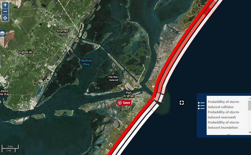
Using the U. S. Geological Survey Coast Change Hazards Portal, here is a look at the Texas coast.
 |
| U. S. Geological Survey Coastal Change Portal Showing Texas Coast. |
As you can see, much of the Texas coast is in danger of inundation or overwash.
Below I zoomed in on an area near Corpus Christie Bay.
 |
| Area Near Corpus Christie Bay Source: U. S. Geological Survey Coastal Change Portal |
I'll added the link to my reference list. You will find on the first page under the poll, surf and tides, and followers.
This is one very useful tool. You can watch it for future Florida coastal events.
---
Unfortunately Harvey hasn't moved much yet.
The system out by the Canary Islands has a 90% chance of becoming a cyclone in the next 48 hours. It could be headed our way.
On the Treasure Coast we have a one to two foot surf. The wind will be from the north this morning, shifting back to the south later in the day. The tides are small now.
---
The blog poll is progressing nicely. Almost 100 people have responded so far. It would be nice to get that number. Only a short time left to respond.
You might want to play around with the Coastal Change Portal a little. I had some other things to post today, but decided to put them off for another day.
I was looking for an old find and ran across what appears to me to be a strange error coin. I also found some other good web sites.
Happy hunting,
Treasureguide@comcast.net
 |
| Source: nhc.noaa.gov |
Unfortunately Harvey hasn't moved much yet.
The system out by the Canary Islands has a 90% chance of becoming a cyclone in the next 48 hours. It could be headed our way.
On the Treasure Coast we have a one to two foot surf. The wind will be from the north this morning, shifting back to the south later in the day. The tides are small now.
---
The blog poll is progressing nicely. Almost 100 people have responded so far. It would be nice to get that number. Only a short time left to respond.
You might want to play around with the Coastal Change Portal a little. I had some other things to post today, but decided to put them off for another day.
I was looking for an old find and ran across what appears to me to be a strange error coin. I also found some other good web sites.
Happy hunting,
Treasureguide@comcast.net